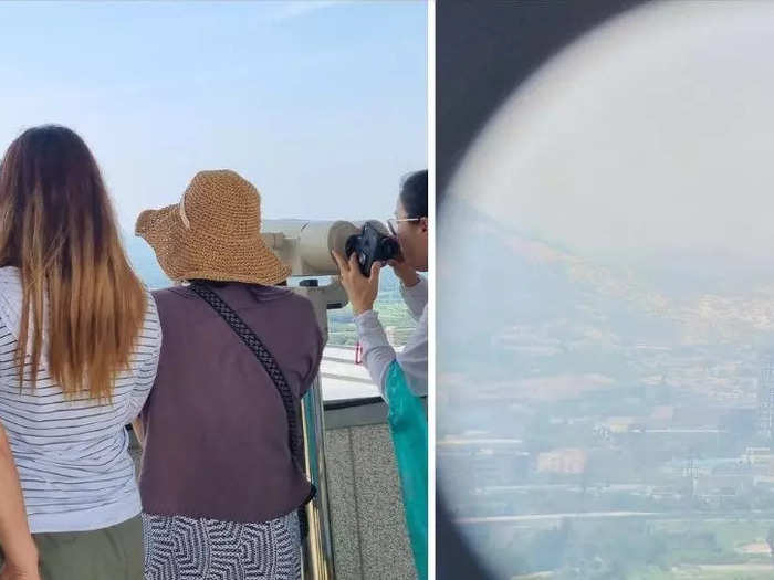
An unobstructed view of North Korea from the Dora Observatory in the DMZ.Reena Koh/Insider
- Last month I went on the DMZ Peace Tour in Paju, South Korea.
- Despite being a "demilitarized zone," the DMZ is the most heavily fortified border in the world.
On June 25, I visited the Demilitarized Zone, or DMZ, between North and South Korea. The day of my visit marked exactly 73 years since the Korean War began in 1950, and the spot I stood at wasn't far from the site where, a couple weeks later, a US soldier would shock the world by darting across the border and defecting into North Korea.
Spanning the 160-mile width of the Korean peninsula, the DMZ is one of the most heavily fortified borders in the world. It was established in 1953 as part of the Korean Armistice Agreement to end the Korean War.
My trip to South Korea was a graduation trip with my five close friends from college. From the start, we knew we wanted to visit Lotte World — a popular theme park — and the BTS bus stop. At one point during our research for the 18-day trip, one of my friends suggested booking a day tour to the DMZ.
In an effort to avoid spending two weeks only focused on shopping and eating, we booked the DMZ Peace Tour on Klook for about $53 USD.
We boarded the tour bus heading for Paju, a city 23 miles northwest of Seoul.
Our tour guide, Emily Lee, showed us a map of the DMZ on the 45-minute bus ride. Reena Koh/Insider
A series of bad decisions the night before — endless shopping and staying up for late-night street snacks — left us feeling sleep-deprived in the morning. After less than three hours on the pillow, we rushed to board the tour bus at 8:30 in the morning.
On the bus, our tour guide Emily Lee began educating us on the history of the Korean War and the DMZ. She spoke in fluent English to our group of about 20 people — ages ranging from early 20s to late 50s — from various parts of the world. She would occasionally slip in a joke or two that would make all of us crack up, shaking off the morning drowsiness.
About 45 minutes later, as we were nearing Imjingak Park, Lee collected our passports — which were needed in order to buy tickets to the DMZ Peace Tour — while passing us a "Team Emily" name-tag to hang around our necks and help prevent us from getting lost.
"Only 40 tour buses are allowed in the DMZ every day," Lee said, adding that since the tickets are issued by arrival, the time at which our DMZ tour starts can only be confirmed at the ticketing office.
Over six million Korean and foreign tourists visit Imjingak Park every year.
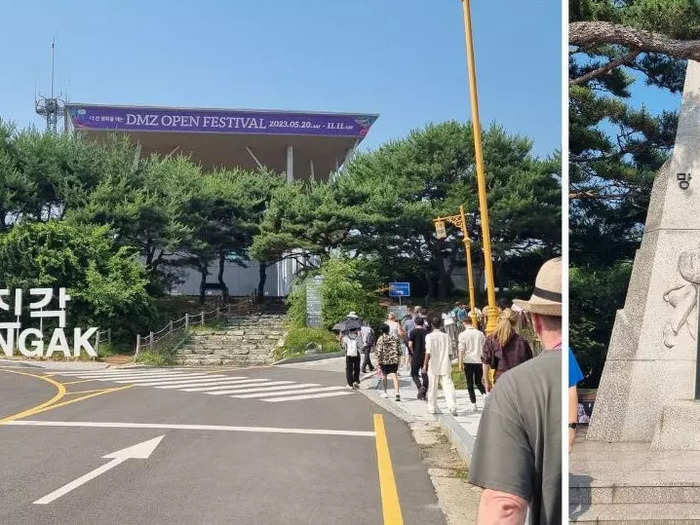
There are several war memorials and monuments within Imjingak Park. Reena Koh/Insider
Built in 1972 as a consolation to separated families and with hopes of reunification, Imjingak Park is a popular tourist attraction for not only foreigners but also South Koreans.
"Many people come here to bike, or to have a picnic," Lee said.
We had two hours before our designated time for the DMZ tour, so Lee guided us around the war memorials and statues. It was about half past nine in the morning and we followed her along in the sweltering sun.
The first monument we stopped at was one dedicated to a song named "30 Years Lost."
It was the theme song for "Finding Dispersed Families," a series of special live broadcasts depicting the reunions of war-dispersed families in 1983. Archives of the series were registered as part of the UNESCO "Memory of the World" collection in 2015.
"Would it be tomorrow or the day after tomorrow, 30 years of waiting with tears," a line of the song read.
"The theme song became very popular in North Korea as well," Lee said.
We walked onto the Freedom Bridge next.
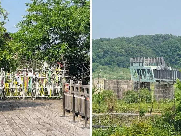
The blocked-off Freedom Bridge (left) and Dokgae Bridge (right). Reena Koh/Insider
The Freedom Bridge was built in 1953 for the sole purpose of allowing 12,773 prisoners of the Korean War to cross over to South Korea. At the end of the bridge stood a barbed wire fence densely covered with prayer-ribbons.
Lee then directed our attention across us to another bridge — the Dokgae Bridge — which used to be a railway bridge that took trains northwards across the Imjin River to the end of North Korea.
"The bridge pier has a lot of bullet marks, which are traces of the Korean war," Lee explained, pointing towards the now-destroyed bridge. Tickets to the bridge pier cost an additional 2,000 Korean won, about $1.60.
Our tour group fell silent whenever Lee explained the gravity of each monument to us. It felt peaceful walking in Imjingak Park, but there was a solemn undertone that followed.
Security at the entrance to the DMZ felt similar to airport immigration customs.
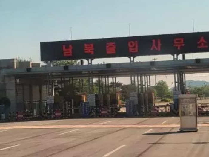
The Inter-Korean Transit Office. Emily Lee
A pair of South Korean soldiers boarded the bus while we had our passports ready in hand. The soldiers verified each and every one of our identities against a names list our tour guide had submitted beforehand.
Taking photos or videos while on the bus ride within the DMZ is also strictly prohibited, so we just enjoyed the scenery while Lee told us the history of our next stop — the 3rd Infiltration Tunnel.
The incomplete 3rd Infiltration Tunnel runs a mile long.
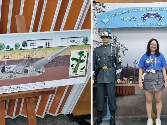
A cross-section map of the tunnel (left) and the writer (right) after walking in the tunnel. Reena Koh/Insider
The 3rd Infiltration Tunnel was discovered in 1978 following the detection of an underground explosion. Though incomplete, it's the largest among the four infiltration tunnels that have been discovered in South Korea.
Running a mile long, at 6.5-foot tall and wide, the tunnel is large enough for 30,000 fully-armed North Korean soldiers to pass through within an hour, Lee explained.
We weren't allowed to take any photos inside the tunnel, so we kept our phones in the lockers, popped on safety helmets, and embarked on our descent 240 feet below the ground.
Walking through the cold but well-lit tunnel felt like a weird fever dream. We were stuck in a single file, and for 10 minutes straight we were shuffling forward while crouching — the 6.5-foot height of the tunnel was actually 5 feet due to structural bars on the tunnel ceiling.
Our next stop was the Dora Observatory, where we had an unobstructed view of North Korea.
Through the telescope, visitors can see the Kaesong Industrial Complex. Reena Koh/Insider
The Dora Observatory was as close as we could get to North Korea. Just a little over 10 miles north of where we stood was Kaesong, one of three major cities in the country, said Lee.
We headed up to the observation deck where there were several telescopes that visitors could use to observe the nearest part of North Korea in detail.
Having only heard and read about the elusive state, it felt bizarre peering through the telescope.
I saw buildings, vehicles, and roads littering the heavily guarded territory — but it was eerily quiet, not a single person in sight.
North Korea was just miles ahead of us.
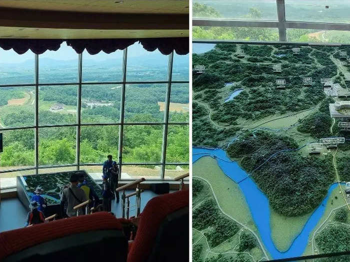
An auditorium with a clear view of North Korea (left), and a map of the area surrounding the DMZ (right). Reena Koh/Insider
On the second level of the observatory, there was an auditorium with floor-to-ceiling glass panels that gave a clear view of the scenic area.
We sat in silence for a while as we took it all in, still feeling surreal about the fact that North Korea was just a few miles ahead of us.
For the last leg of the tour, our bus passed through the Unification Village.
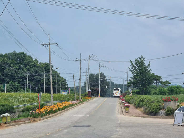
The Unification Village looked just like any regular, peaceful village. Reena Koh/Insider
The Unification Village, located 2.7 miles south of the Military Demarcation Line, is home to around 160 families and a total of about 460 residents. It's the biggest of the three villages within the Civilian Control Line, Lee said.
Our bus drove through the quiet, peaceful village, before concluding the tour at the village's souvenir shop and restaurant, where local specialties like sundubu — soft tofu — and seasoned mountain herbs were sold.
As we headed back to Seoul, I felt a mixture of emotions well up inside me.
I had fun on the tour — and at some points it felt reasonably commercialized — yet there was a strong tinge of sorrow in each step of the journey.
Every part of the tour was a silent but grim reminder of the heart-wrenching reality of the divided peninsula, the millions of people who were — and still are — deeply hurt by the Korean War.
"After the Korean War, millions were separated from their families. Randomly, they became North and South Korea," said Lee, "it wasn't their choice, but they haven't met for 70 years."

