How to use the best new feature in Apple Maps
In a city where Apple Maps provides public transit directions, like New York City, you'll see available options, like subway stations and bus stops. Apple has done a good job of clearly labeling subway lines with their respective colors.

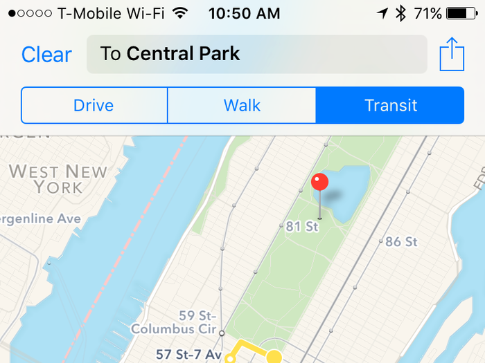
To use public transit directions, just type in where you want to go and select the new "Transit" option next to "Walk" and "Drive." At the bottom of the screen, Maps will suggest the quickest route to get to your destination.
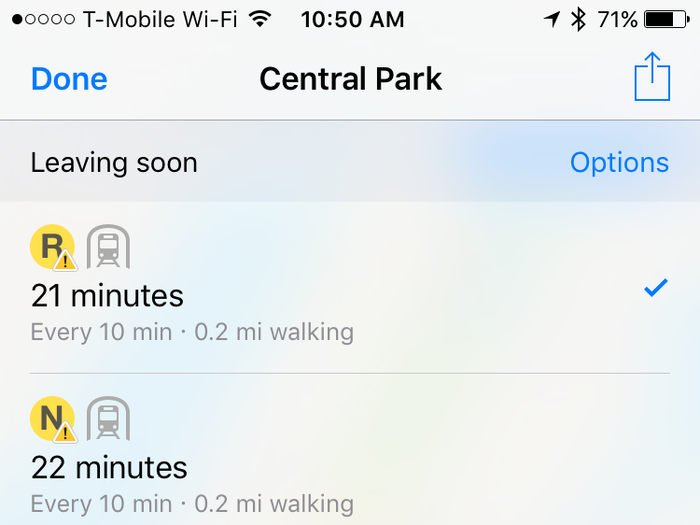
If you tap the "More Routes" option at the bottom of the screen, you'll see a list of other ways to get where you're going.
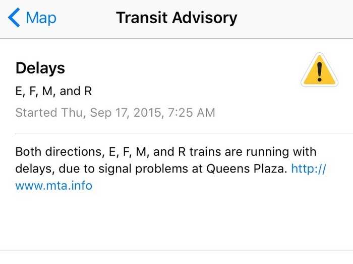
Maps integrates with organizations like the Metropolitan Transportation Authority, the body that oversees New York's public transportation, to show delays.
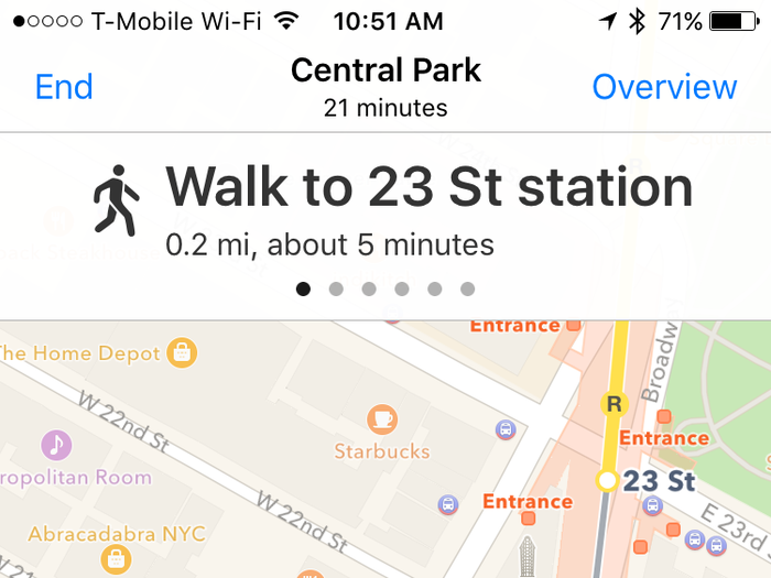
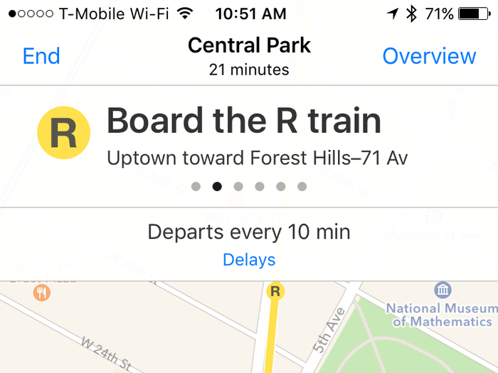
When you start a route, the app will guide you to the stop. Swipe left on the written directions at the top of the screen to go to the next phase of the journey.
Maps tells you how often a subway or bus departs from each stop. Apple has done detailed mapping of subway stops to help you visualize their layouts.
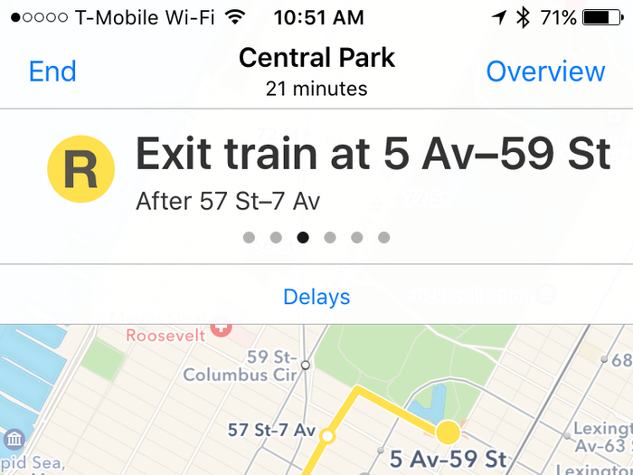
Once you board, you'll see where you're headed. The little dots represent each stop along the way.
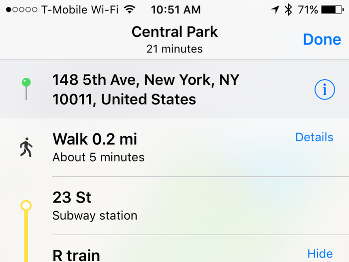
Tap the middle button at the bottom of the screen and a list view of your directions will appear.
Maps will tell you where to exit your stop, which is super helpful if you're not familiar with the layout of a station.
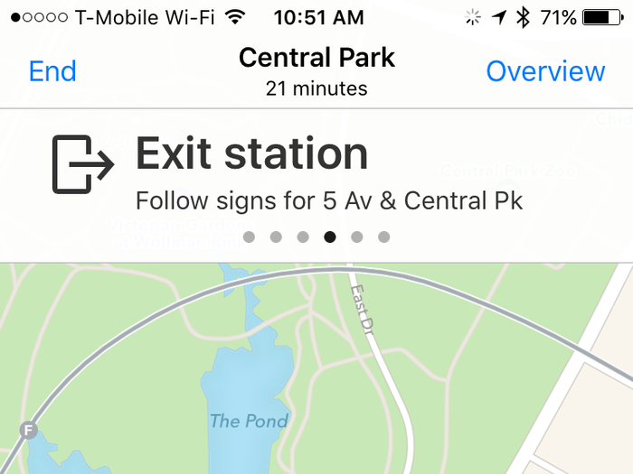
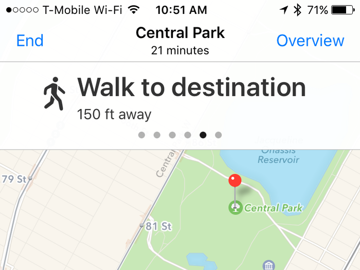
Almost there!
There's another way to see public transit near you in the Maps app. When you're typing in a destination, tap the blue "Transport" bubble.
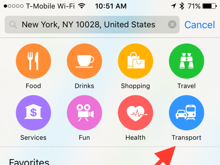
You'll get several different kinds of transportation options, including nearby stations and bus stops.
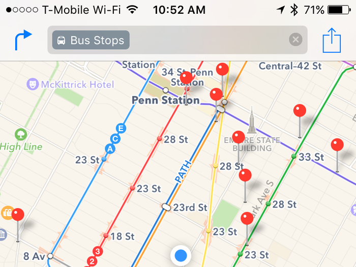
Tapping on bus stops, for example, will show pins for all the nearby stops in your area.
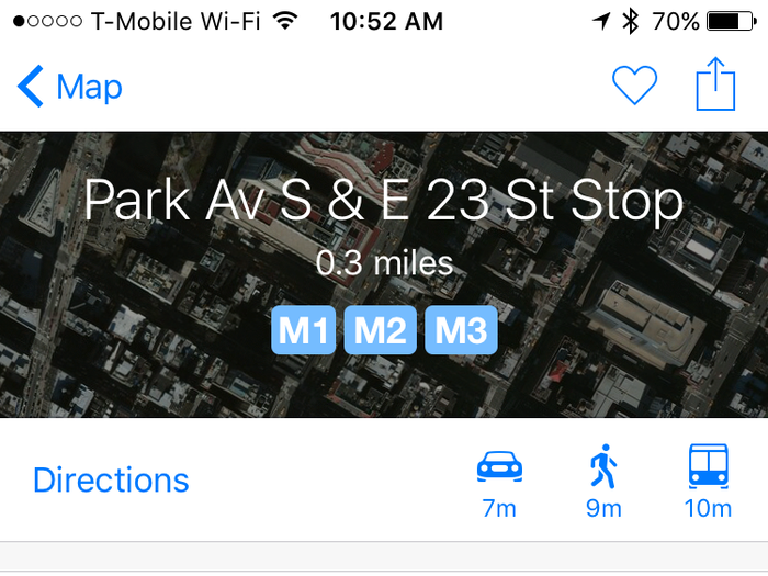
Tapping on an individual stop will show you when the next bus is arriving and how often it departs. You can also see delay details and start a route to the stop.
Apple Maps or Google Maps will likely fulfill most of your public transit needs, but if you use the bus or subway a lot and wan an app with more features, check out Citymapper.
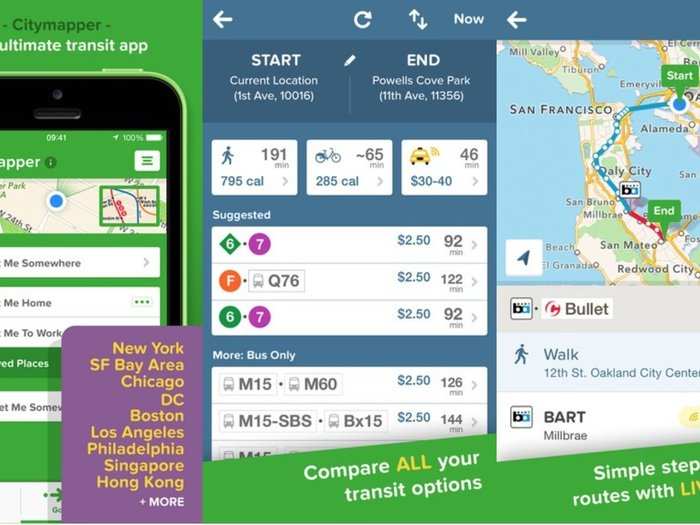
It's a free download for the iPhone and on Android.

Popular Right Now
Popular Keywords
- India’s wearables market decline
- Vivo V40 Pro vs OnePlus 12R
- Nothing Phone (2a) Plus vs OnePlus Nord 4
- Upcoming smartphones launching in August
- Nothing Phone (2a) review
- Current Location in Google
- Hide Whatsapp Messages
- Phone is hacked or not
- Whatsapp Deleted Messages
- Download photos from Whatsapp
- Instagram Messages
- How to lock facebook profile
- Android 14
- Unfollowed on Instagram
Advertisement