Sneak peek at the highest-resolution 3D map of the Moon that Chandrayaan 2’s orbiter is putting together
Chandrayaan 2’s night vision

Why do we need a map of the lunar poles?
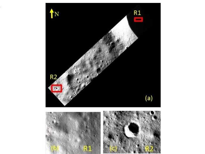
(a) OHRC image showing the rim and floor of Boguslawsky E crater and nearby area. (b) Region R1 in crater floor that has been illuminated by the rimreflected light. (c) Fresh crater with boulders (R2)
The orbiter has plans to map the lunar poles — where the Sun never shines. Scientists don’t have a very cohesive understanding of what lies in those regions. However, they have deemed them integral to future human habitation on the Moon.
Planning for human habitation of the Moon
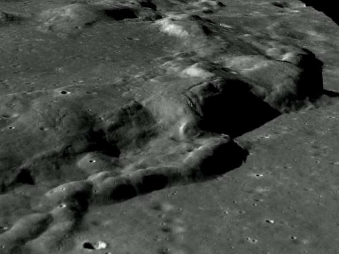
3D view of a Dorsa from the generated DEM of Orbit no.1305 of TMC-2 datasets
“High-resolution images of OHRC will be useful for understanding recent volcanic, tectonic, mass wasting and impact cratering processes through the study of features,” said the study.
Understanding the terrain is important in this case because it will allow future astronomers to plan long-term missions.
How did the Moon get its craters?
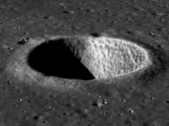
3D view of a crater from the generated DEM of Orbit no.628 of TMC-2 datasets
Mapping out the terrain is only one part of the story. The TMC 2 has been pulling its weight as well. It has already beamed back images that help astronomers under how lunar features form and get their shape.
With a 3D map and images, scientists can begin to understand the geometry of impacts that formed the Moon’s craters.
The hunt for water and minerals
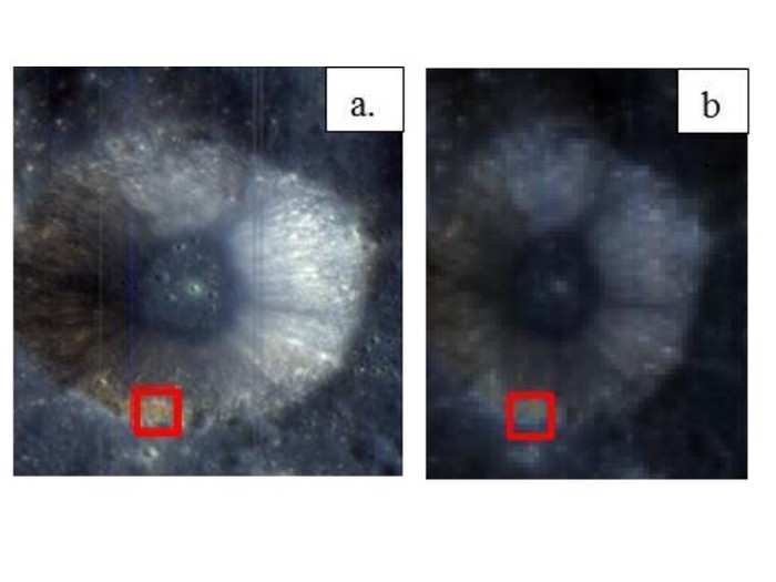
a. Chandrayaan-2 IIRS image showing crater Glauber situated south of Mare Moscoviense
b. The same crater as imaged by Chandrayaan-1 M3
Combining 3D images with the infrared imaging, ISRO can also map for minerals — and the IIRS has a tough legacy to follow. Its predecessor abroad Chandrayaan 1, the Moon Mineralogical Mapper (M3) was the first to find water on the Moon.
Both instruments reflect sunlight off the surface. The patterns of how the infrared reflections are distributed can indicate where there may be water — and where there isn’t.
In the endeavour to live up to expectations, the IIRS boasts of twice the sensitivity of M3.
Where is water on the Moon?
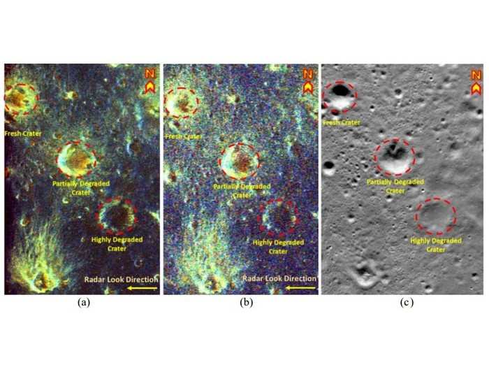
Raney decomposed image of study area acquired by (a) Chandrayaan 2 DFSAR L band; (b) LRO Mini-RF S band; (c) corresponding optical image acquired by LRO Narrow Angle Camera image.
Supporting the IIRS in its mission is the DFSAR. The instrument can peer below the surface of the Moon to actually quantify the amount of water that may be stored in potential water-rich regions.
The polar regions, in particular, are estimated to store more than 600 billion kilos of water ice by past studies.
What’s next for the Moon?
In addition to figuring out where it is safe to land and where habitats can be set up when humans eventually decide to stay on the Moon for long periods of time — it’s also important to know what supplies are needed.
Scientists are hoping that the stores of water on the Moon will reduce the baggage of future missions significantly — and could serve as a backup plan of humans back on Earth when the planet eventually exhausts its own reserves.
See also:
Jeff Bezos and Elon Musk have more in common than just being billionaires
Moon landing drama: Play by play of ISRO losing communication with Chandrayaan 2's lander
READ MORE ARTICLES ON
Popular Right Now
Advertisement