I went to Brooklyn for the chance to see a satellite image of the area in the Nevada desert that mysteriously wasn't updated on Google Earth for 8 years
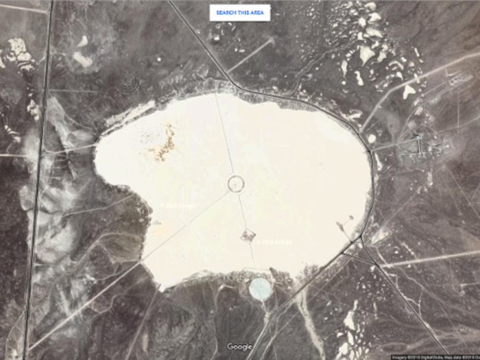
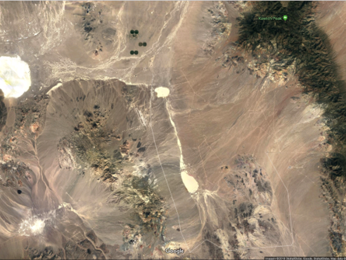
First, the important context about the surrounding location: This is the Tonopah Test Range, located a few miles from the dry lake beds.

Google relies on a mixture of third-party satellite images and aerial photography for its Earth service — the company purchases the rights to use satellite and aerial images, and then stitches them together in Google Earth.
When aerial photographs can't be taken because of restricted airspace, Google buys satellite images that meet their requirements: a proper resolution, no clouds blocking the view, and correct colors. Byrne and Mehrotra found one of those-third party sellers, Apollo Mapping, and discovered and purchased images from the omitted time period that seemed to meet these requirements.
At this point, the pair became suspicious. It almost certainly wasn't a coincidence that a United States Air Force base was the one location on Google Earth that went the longest without an update. What they weren't sure of, however, was how that happened. At the event in Brooklyn, the pair said it's not clear if the government contacted Google and requested the images to be omitted.
However, the purchase of those satellite images came with some stipulations.
Throughout the legalese that accompanied them, the pair kept coming across the phrase "For internal use only." Essentially, that meant the images could only be viewed by employees of Eyebeam, a Brooklyn art collective and co-op that Mehrotra is a resident of.
The pair decided that they wanted to display what they had discovered, but they also didn't want to get sued. So they chose to host a showing of the images at Eyebeam, accompanied by artist renditions of the satellite images by Sebastian Gladstone, poetry by Marvin Mayfield, and discussions with Yahoo News DC bureau chief Sharon Weinberger and Mark Bradford, who owns a law firm that specializes in copyright law.
But there was still the issue that the images were for "internal use only."

Only Eyebeam employees were legally allowed to view these images. To get around this obstacle, Eyebeam hosted an event at its Brooklyn location where every attendee had to sign a contract, making them a temporary independent contractor for Eyebeam. Each attendee received one dollar as their pay.
I signed the contract, theoretically making me an official Eyebeam contractor for a 24-hour period.
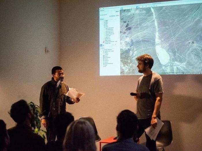
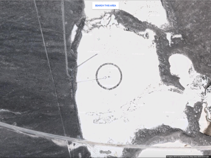
The discussion was kicked off by Mehrotra, who began by talking about how he discovered this anomaly in the first place. By studying the bulk of data from Google Earth over the years, Mehrotra realized there was a small area in Nevada that went dark for eight years.
This area was the Tonopah Test Range.
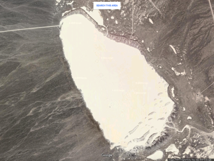
Mehrotra then displayed the images for the audience, which didn't look much different than the examples that are available on Google Earth. This raises an important question: what was so significant about that eight-year period that resulted in a lack of update on Google Earth?
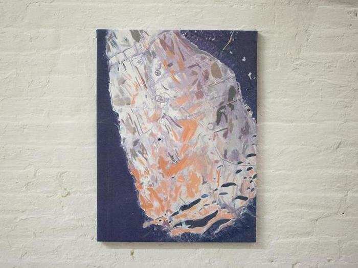
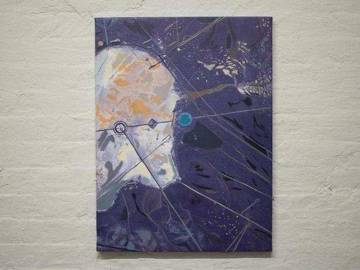
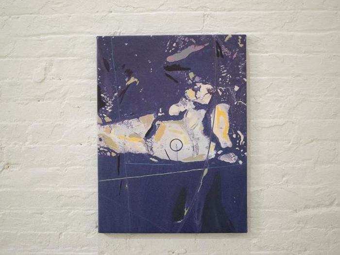
Next, artist Sebastian Gladstone spoke about his renditions of the map.
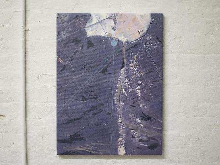
Since the actual images couldn't be distributed without the fear of legal repercussions, Gladstone had to render his paintings in "good faith" — he wanted them to be true to his artistic vision, but also legally sound.
Yahoo News DC bureau chief Sharon Weinberger spoke with Mehrotra, and the two speculated about what could have been tested at Tonopah that was significant enough to result in a Google Earth omission.
Weinberger admitted she had no idea what was being tested there, but guessed it could have been some sort of military plane or weapon.
Mark Bradford, who specializes in copyright law, spoke with Mehrotra and Gladstone about the project, and whether it was protected from legal repercussion.
The three discussed Gladstone's work, the event in general, and how art can intersect with copyright law.
Finally, Marvin Mayfield performed an original poem that he wrote for the event, touching on themes of the Earth as a mother, and the various ways its children (humans) have desecrated her through weapons testing.
Unfortunately, there's no real way to know for sure why these satellite images weren't included in Google Earth for so long.
Google recently added images of the area from 2014 and 2015, shortening the gap of missing photos to 2006-2013. After the publication of the Motherboard piece, Google offered the following statement to Motherboard:
"Google Earth didn’t censor this area in Nevada. Our satellite imagery is licensed from third party providers which are commercially available and are not the property of Google. We update imagery by prioritizing areas that are most popular with users while complying with local and federal laws.”
Read the full story about the pair's investigation over at Motherboard.
Popular Right Now
Advertisement