Facebook built a tool last year to map the spread of diseases. Now it's being used to combat coronavirus. Here's how it works.
Disease Prevention Maps are capable of showing movement by aggregating data from people using Facebook apps on their phones with location services enabled.

Facebook also compiles population density maps using a mix of data aggregated from its platform, satellite images, and census data.
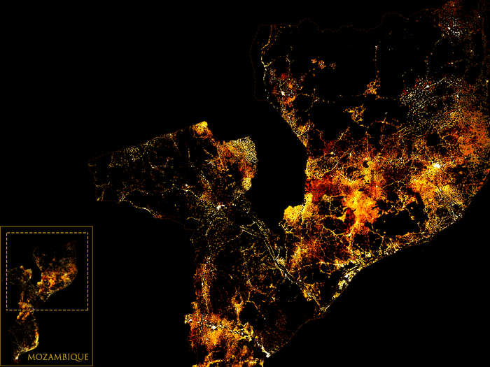
This map shows the density of people over the age of 65 in Mozambique. Mapping demographics like this can help healthcare experts identify at-risk areas.
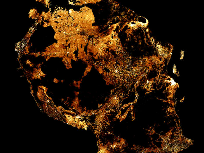
The 3rd type of map Facebook offers shows the density of network coverage in specific areas, which is meant to help health service organizations plan how to distribute information and aid.

This map, published by Facebook in 2019, shows 3G network coverage across Congo.
Facebook has aggregated high-resolution population density maps and made them publicly available.
Facebook's database of high-resolution population density maps is available via the Humanitarian Data Exchange.
Facebook insists that the data used for its Disease Prevention Maps is anonymized, relying only on data that's de-identified and aggregated.
Privacy advocates have recoiled at the idea of a sweeping partnership between tech companies and governments, especially the prospect of the US government building a database of people's movements based on data from platforms like Facebook.
Anonymous White House sources working on a collaboration with Facebook to combat COVID-19 told The Washington Post that, if the project moves forward, it would not involve a government database.
The maps are already being used for COVID-19 prevention by organizations including Harvard's School of Public Health, National Tsing Hua University, University of Pavia, Direct Relief, London School of Hygiene and Tropical Medicine.
"One of the most important pieces of information we need to respond to epidemics is where people are moving. This kind of data can be integrated into our epidemiological models to help us estimate how quickly a disease might spread, and where to put resources to contain it," Caroline Buckee, a Harvard School of Public Health professor, said in a statement shared by Facebook.
Popular Right Now
Advertisement