NASA
- The National Aeronautics and Space Administration (NASA) has shared some harrowing pictures from outer space of Cyclone Amphan as it moves up the Bay of Bengal.
- It’s been tracking the first tropical storm of the season with a slew of satellites.
- Here are some images that show how the cyclone moved from the wide expanse of the ocean to hit land in India and Bangladesh.
Cyclone Amphan is wreaking havoc on the coast of Bangladesh and India as it tears through the Bay of Bengal. It’s the first tropical storm of the season and the National Aeronautics and Space Administration (NASA) has been tracking its progress with satellites. It has sent back harrowing images of the natural disaster delivering a “substantial storm surge” to coastal areas.
Even winds speeds have decreased, according to the Indian Meteorological Department (IMD) as the cyclone made contact with land, it still packed enough power to destroy buildings, uproot trees and takedown powerlines.
These are some images of Cyclone Amphan as it makes its way across the North Indian basin:
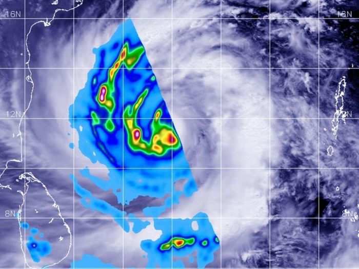
Cyclone Amphan on May 17 at 1:00 pm IST
NASA
Global Precipitation Measurement (GPM) core satellite passed over the Northern Indian Ocean on May 17 at around 1:00 pm. The weather data has been overland on cloud imagery from Japan’s Himawari-8 satellite.
GMP was able to observe rainfall rates occurring on the western side of the newly formed and very large tropical Cyclone Amphan. The heaviest rainfall has been highlighted in pink. However, most of the rainfall was noted to be around 25mm per hour shown in yellow areas.
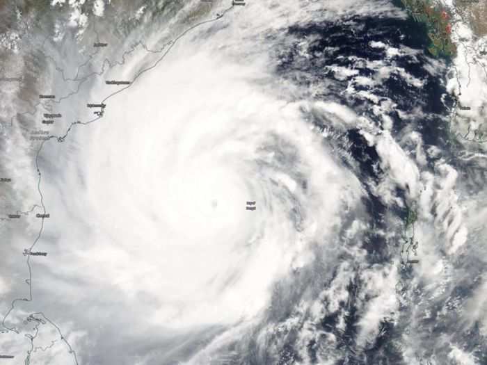
Cyclone Amphan on May 18 at 2:30 pm IST
NASA
NASA-NOAA’s Suomi NPP satellite shows the visible image of Cyclone Amphan on May 18, just off the eastern coast of India. You can see vast storm over the open ocean, stretching from Sri Lanka, past the Indian states of Tamil Nadu to Andhra Pradesh.
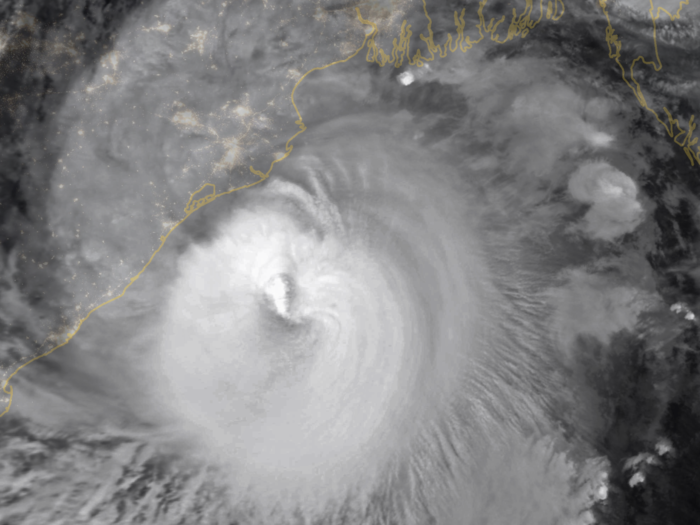
Cyclone Amphan on May 19 at 9:45 pm IST
NASA
The photo was taken using Moderate Resolution Imaging Spectroradiometer (MODIS) on NASA’s Terra satellite, overlaid on Black Marble nighttime satellite imagery. At the time, Cyclone Amphan was recording speeds of around 185 kilometres per hour, making it a category 3 storm on the Saffir-Simpson wind scale.
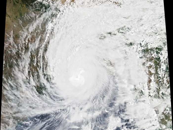
Cyclone Amphan on May 20 at 1:00 pm IST
NASA
The image was captured using the Moderate Resolution Imaging Spectroradiometer (MODIS) on NASA’s Aqua satellite on May 20 at around 1:00 pm. At the time, Cyclone Amphan was recording speeds of around 165 kilometres per hour — putting it at category 2 on the Saffir-Simpson wind scale.


