Incredible new satellite photos reveal Antarctica's huge iceberg in stunning detail
In just two to three years, the new iceberg could fully melt — or at least turn into countless chunks of sea ice.

Glaciologists say iceberg A-68 will continue to break into smaller chunks as it floats northeast and into the opens seas of the Southern Ocean.
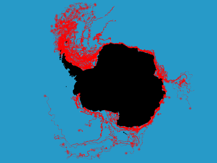
The image above shows the paths other icebergs have taken after breaking off of Antarctica.
Most likely, iceberg A-68 will drift toward the warmer waters of Falkland Islands, though many larger icebergs go farther east to the South Georgia and South Sandwich Islands.
Source: Business Insider
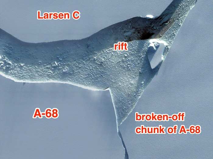
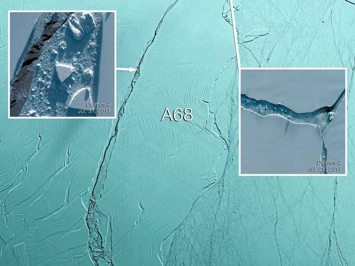
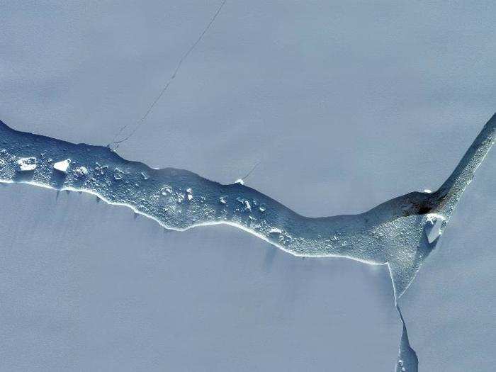
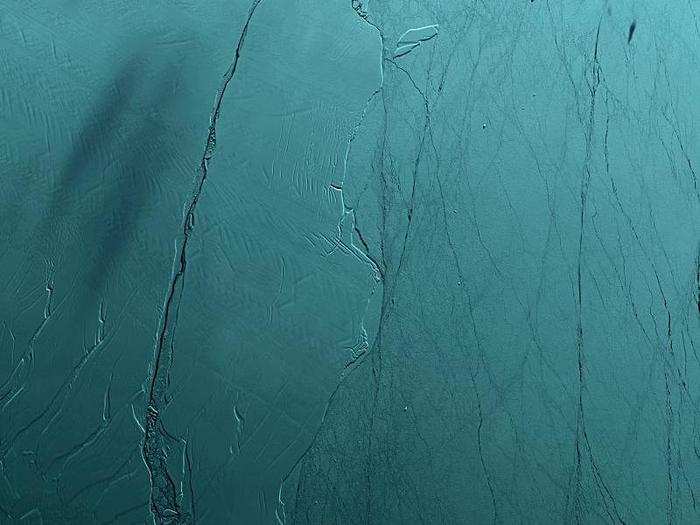
This image shows the point where Larsen C meets A-68 and a new broken-off chunk of the iceberg.
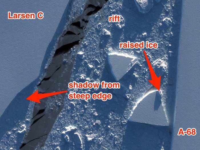
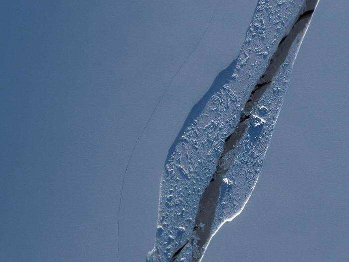
Similar details pop out in a scene of the iceberg's northernmost flank. On the top right, new cracks in the Larsen C ice shelf are visible.
The sun — low on the horizon during Antarctic winter — casts long shadows that reveal the cliff-like edges of the rift and its iceberg chunks.
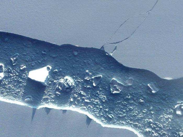
Zooming in on some of the details from Deimos-2 is revealing. This image shows mini-icebergs in a slush of ice between A-68 and the main Larsen C ice shelf.
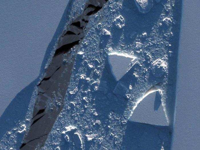
Here's how those images fit together in the larger context of the ice shelf.
And this image shows a northern region of the iceberg and ice shelf.
Days later, Deimos-2 swung by and took two zoomed-in, very-high-resolution images of the iceberg and the rift that spawned it. This view shows a mid-eastern section of the rift.
In late July, Deimos-1 captured this image of the Antarctic Peninsula and the eastern edge of its Larsen C ice shelf — where iceberg A-68 (center) broke off.
"Thanks to its wide swath and high revisit time, Deimos-1 spotted where the main developments were going on in the Larsen C Ice Shelf and its surroundings," Ana Isabel Martinez, a writer for Deimos Imaging, wrote in a blog post.
Deimos-1 and Deimos-2 follow similar orbits and work together to image the same spots on the ground in medium- and very-high-resolution
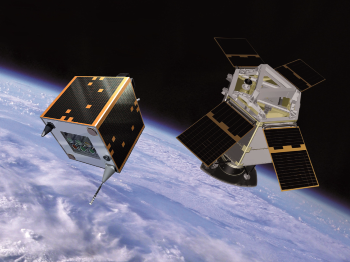
Deimos-1 (left) takes wider-angle, medium-resolution images while Deimos-2 (right) takes zoomed-in, very-high-resolution pictures.
Popular Right Now
Advertisement