Epically awesome photos of Mars
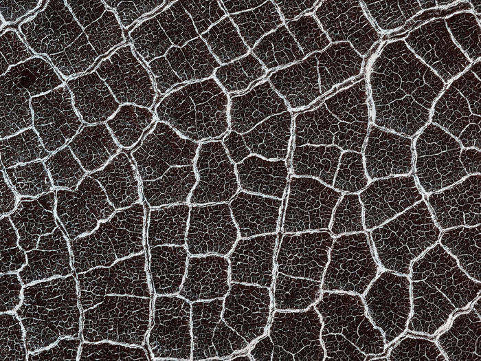
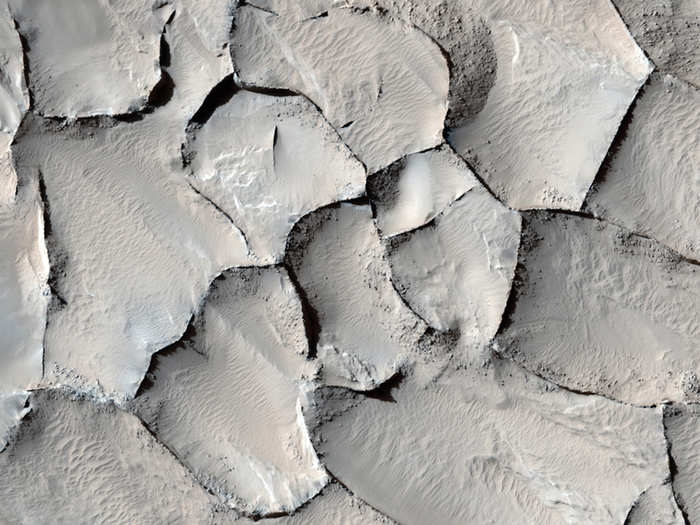
During the summer on Mars' north pole, all of the surface ice is gone revealing the cracked surface underneath. The cracks are likely from underground ice expanding and contracting with the seasons.

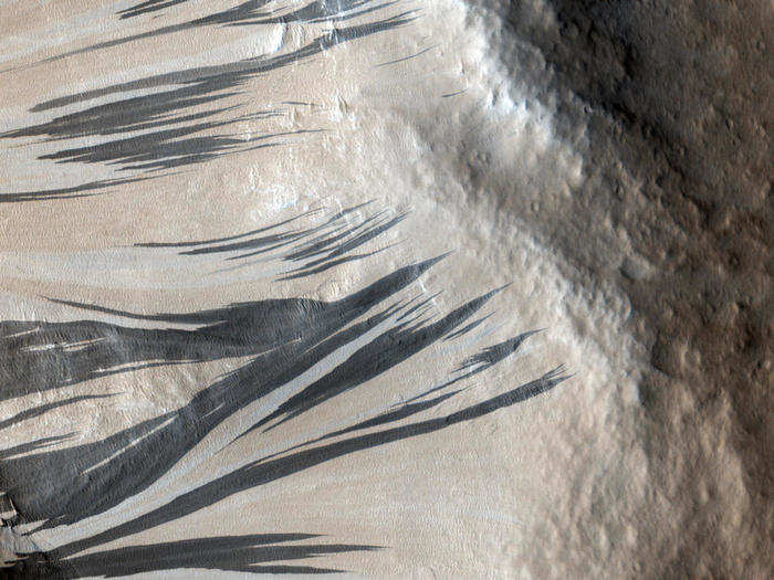
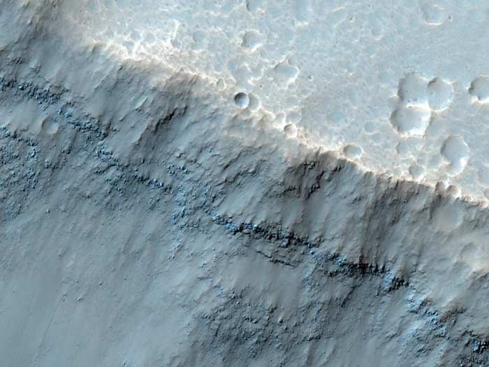
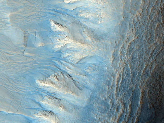
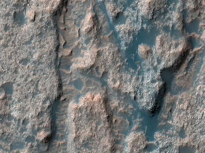
Dark and light streaks crawl up a ridge in this picture of the Acheron Fossae region. Scientists debate over how the different-colored streaks formed, but they agree that the darker streaks are younger that turn into the lighter streaks over time.
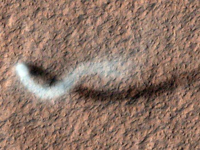
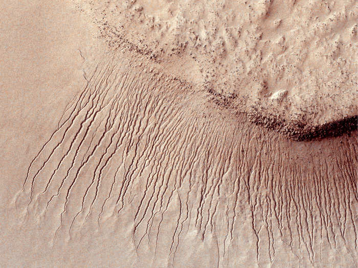
Believe it or not Mars has dust devils and this mesmerizing picture shows the tracks that they trace in the sandy Martian surface.
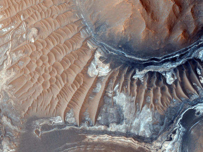
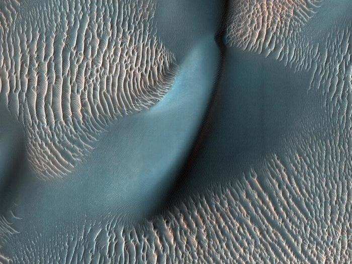
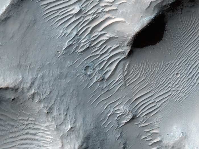
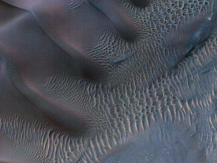
Shown here are plateaus with gentle slopes lined with almost perfectly-spaced sand dunes. This spacing is sensitive to wind that helps give scientists clues of the sedimentary history of the surrounding terrain.
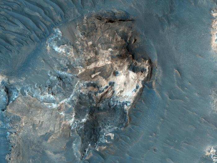
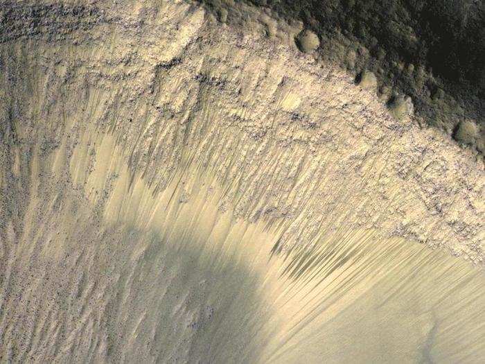
This is of a flat-topped hill with steep slopes that's part of the Capri Mensa region, which is located within one of the largest canyons in the entire solar systems.
The polar caps on Mars contain frost shown here in white. But the frost isn't water-based, it's made of carbon dioxide. When temperatures heat up in the spring, this frost changes from its solid form directly to a gas in a process called sublimation.
There's a maze on Mars called Noctis Labyrinthus, which means "labyrinth of the night." Shown below is part of this maze known for its steep-walled valleys that twist and turn across the Martian surface.
On one late-spring afternoon, the HiRISE camera snapped this picture of a towering dust devil in the Amazonia Planitia region on Mars. The plume is about 100 feet across and more than half a mile high!
Near the equator on Mars is the Aram Chaos region and shown below is a very eroded portion of this area. The distinct strips of color indicate a change in the chemical properties of the rock.
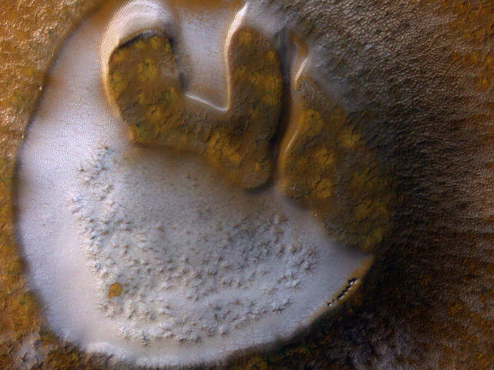
These honeycomb-shaped features are common on Mars. Shown in white is frost that outline frost-free basins located in the northern lowlands on Mars.
When the ice on Mars sublimates, wind can get at the exposed dirt and dust underneath. The black patches you see here in the planet's north polar region is pockets where ice disappeared and wind blew away the loose dust underneath.

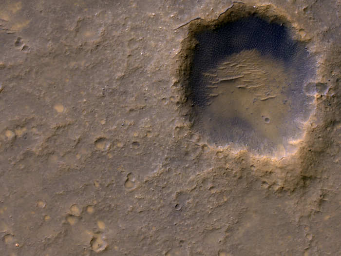
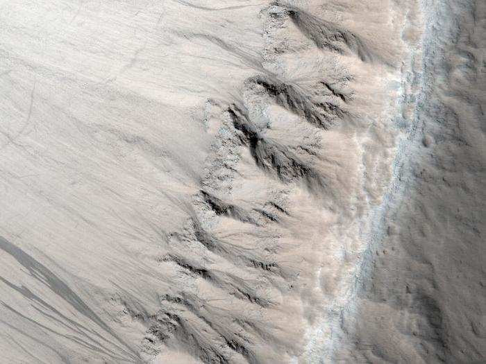
Here is the rim of a crater, which scientists think is relatively new because of how sharp it's etched in the surface. This crater rests in the mid-latitudes of Mars.
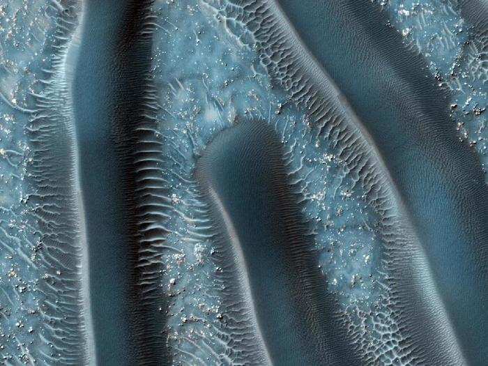
Proctor Crater is famous for its dunes, shown in exquisite detail here. In fact, these are some of the first sand dunes ever discovered on Mars.
This is what is referred to as an inverted crater. The dark-blue dunes circling the crater come from the basaltic volcanic rock. The inverted crater is in the Arabia Terra region and measures 800 feet across — about the length of 5 Olympic-sized swimming pools.
Pictured here is an area about two-thirds of a mile across in the Aureum Chaos region, which is a famous part of Mars that was first mapped by astronomer Giovanni Virginio Schiaparelli more than 100 years ago.
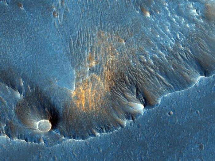
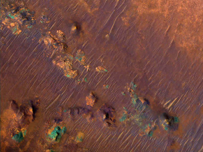
The Nili Fossae region on Mars is incredibly rich in clay deposits, shown here in orange. Organic materials could be preserved in this water-infused clay, which is why scientists are especially interested in this region on Mars. The blue-green regions are rocks rich in pyroxene, which is common in igneous rocks on Earth.
One of the longest ancient valleys on Mars is the Samara Valles, which is 621 miles long. Shown here is a heavily cratered portion of the valley. The craters show up as circles that overlay the sand dunes.
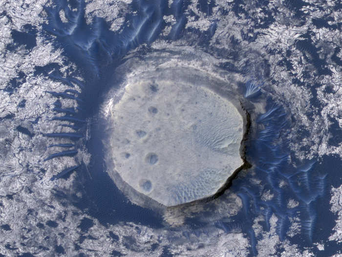
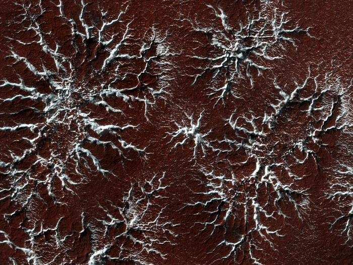
When temperatures heat up in the Spring, the carbon-dioxide ice in the polar caps sublimates into the atmosphere leaving behind these distinct starburst patterns. Why the melting process makes these characteristic patterns is a subject of ongoing research.
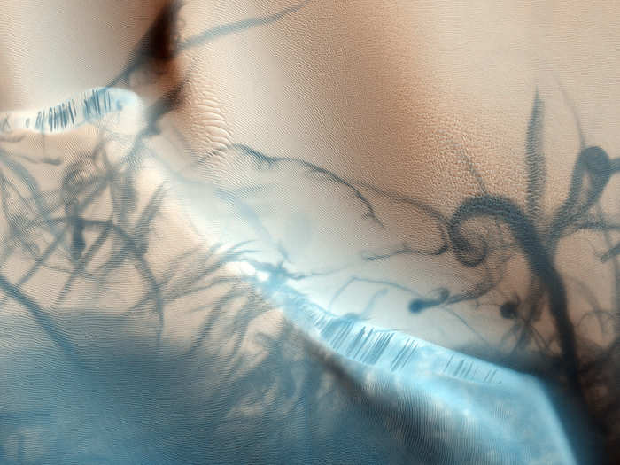
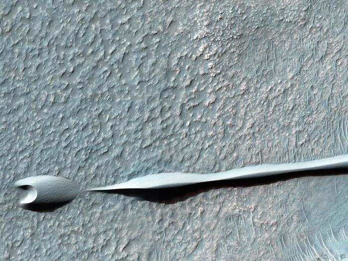
Looking like a serpent swimming across Mars' Hellas impact basin is this sand dune, which formed when Martian winds blew the same direction for a long period of time, in this case from east to west. These types of dunes, called barchan, are also common in desert regions on Earth.
What created this jagged cracked surface in the Gordii Dorsum region on Mars is unknown. The rippled sand dunes suggest that these cracks were once large dunes themselves that then mysteriously hardened over time.
The gullies in the left of this image are a topic of much debate. Scientists suspect that they either formed from flowing water, liquid carbon dioxide, or something else. There's evidence of extensive deposits of ice in this region of the northern half of Mars, which supports the theory that running water could have made these features.
The channels in this image are between 3 to 33 feet wide. They're located in one of the largest impact craters in the solar system called the Hellas impact basin. The crater is in the southern hemisphere on Mars.
The textured surface in this image is part of the Palos Crater near the Martian equator. Scientists think that Palos Crater could have once harbored a lake that then drained to the north.
Layers of rock are stacked like a staircase in this image of the Samara Valles. The pink substance in the upper right is opal, which happens to be the national gemstone of Australia.
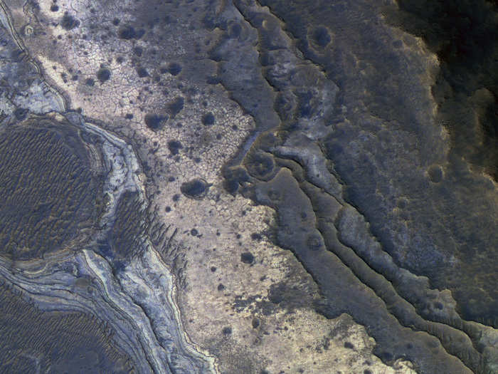
This is a part of a heavily cratered region on Mars called Aureum Chaos. The jagged terrain shows evidence of channels and erosion that scientists think formed from massive flooding in Mars' distant past.
In the lower left corner of this image, which is about 2,000 feet across, is the platform that NASA's Spirit Mars rover drove off after landing in 2004. Most of Spirit's investigations happened about two miles east of its landing site.
This arresting image of sand dunes in the Noachis Terra of Mars spans a little over half a mile across. The different sizes and shapes of sand dunes are from changes in wind direction and wind strength over time.
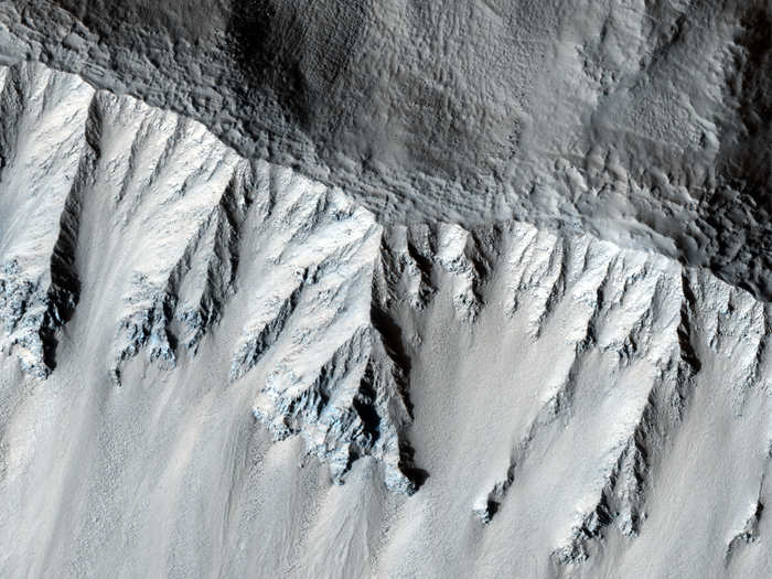
The steep slope of a crater, shown here, is located on the floor of Valles Marineris — a colossal canyon 2,500 miles long. The canyon is clearly visible from space, stretching across the Martian equator.
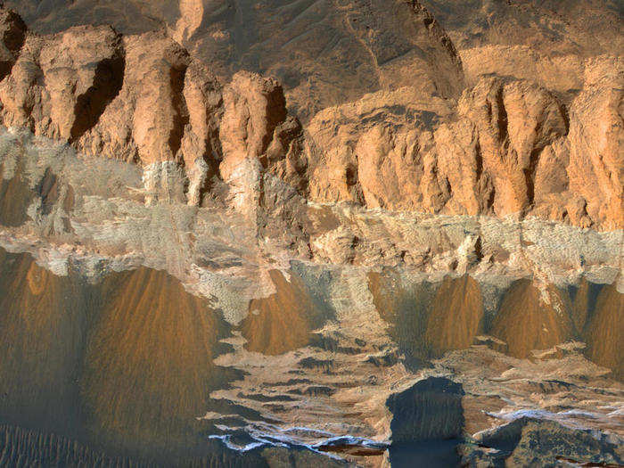
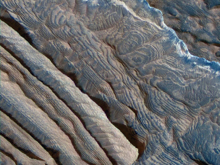
The Arabia Terra are highlands thought to be one of the oldest terrains on Mars. This is an image about 1.2 miles across showing part of the Arabia Terra, which stretches 2,800 miles across the surface. The uniform layers are each about 33 feet high.
Geologists think that this textured terrain, which resembles features in the Colorado Plateau, formed when lava in the area cooled unusually quickly from flooding. For scale, the picture spans half a mile.
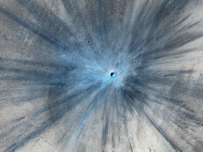
Researchers know that this crater is fresh because the dust it kicked up on impact is overlying the surrounding area. The crater itself is 100 feet wide while the long, dark streaks stretch as far away as 9.3 miles. Few impact craters on Mars have scars as dramatic as this one. The crater is not actaully blue, but falsely colored to highlight the impact ejecta.
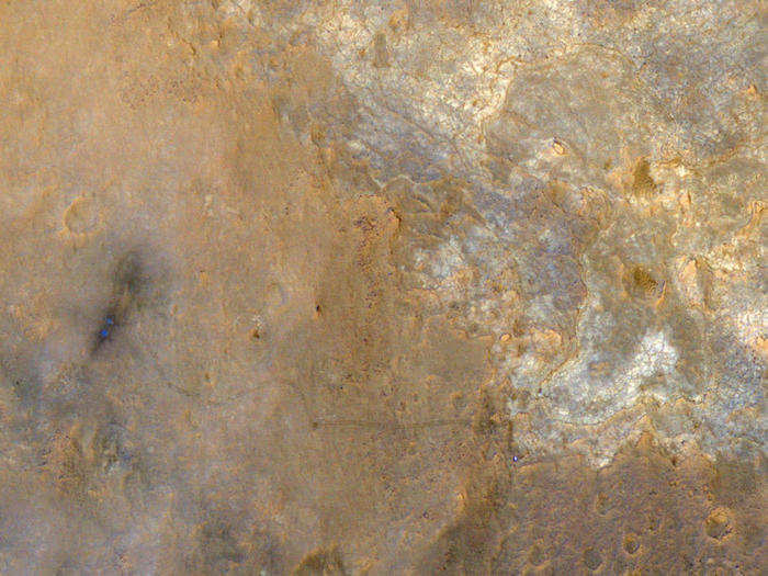
In the lower right corner you can see a tiny, bright dot, which is NASA's Mars Science Laboratory rover Curiosity. And trailing behind the rover are the tracks it etched in the dusty surface as it drove away from its landing site near Gale Crater.
NASA's Mars Exploration Rover Opportunity explored this hole in the ground, called Victoria Crater between 2006 and 2007. The crater is about half a mile across and named for the first ship to ever circumnavigate the Earth.

Now that you've seen Mars, check out the rest of the beautiful universe.
Popular Right Now
Advertisement