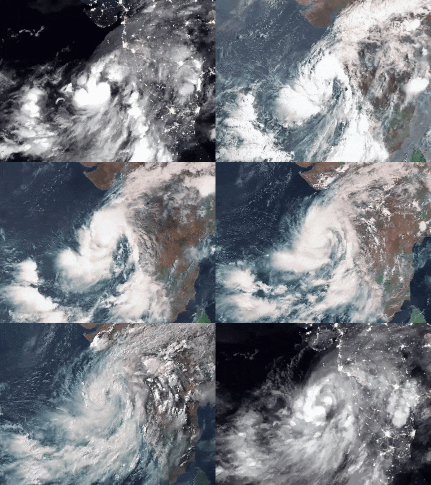
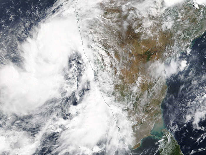
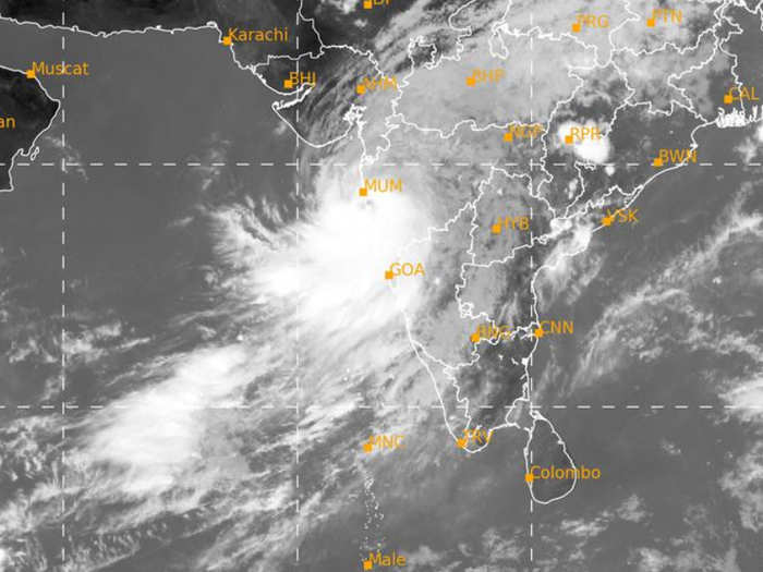
Satellite images show the build up Cyclone Nisarga from outer space as it inches closer to India's west coast ZoomEarth/EUMETSAT/Meteosat-8
- Cyclone Nisarga has made landfall in Maharashtra.
- Alarming images from satellites show the build-up of the severe cyclonic storm as it was inching towards India’s west coast.
Cyclone Nisarga just hit Maharashtra its landfall near Alibaug, which is a mere 45 kilometres from India’s financial capital and home to Bollywood — Mumbai. Satellite images show how the severe cyclonic storm is inching closer to India’s west coast.
This storm is truly unique because cyclones aren’t as common in the Arabian Sea as compared to the Bay of Bengal, making Nisarga an exception to the norm. And, it’s coming within two weeks of Cyclone Amphan already laying waste to large parts of Odisha and West Bengal.
Here are some images from outer space that show how the storm is building up down on Earth:
Zoom Earth shared this image of Cyclone Nisarga as it gained intensity last night and headed towards the coast of Maharashtra
Zoom Earth
Zoom Earth shows near real-time satellite images. Images from NOAA GOES and JMA Himawari-8 satellites are updated every 10 minutes and EUMETSAT Meteosat images are updated every 15 minutes. You can track the storm live on their website.
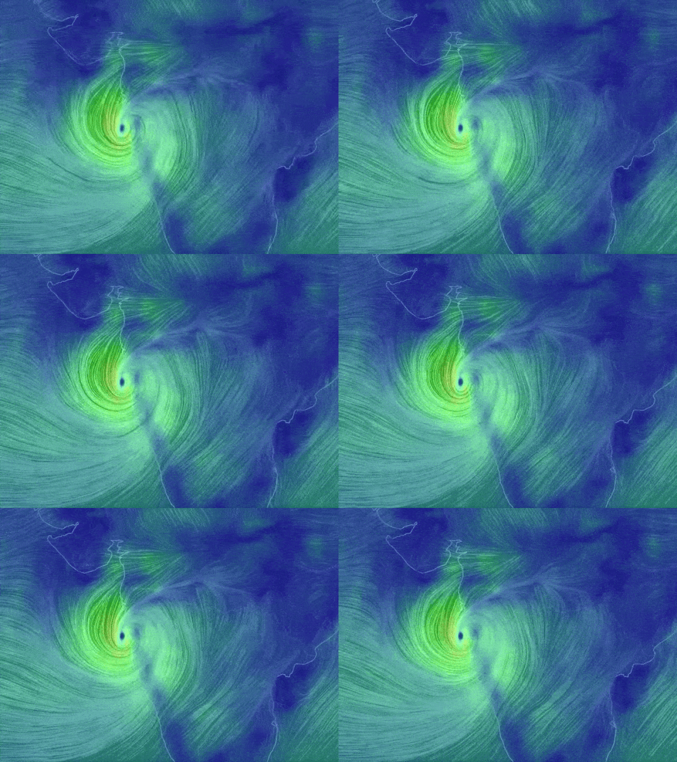
NullSchool simulator shows how the high winds are circulating around Cyclone Nisarga
Earth Null School
The simulator uses supercomputers to generate weather and ocean data from numerical models. High winds are shaded in yellow and mild winds in green.
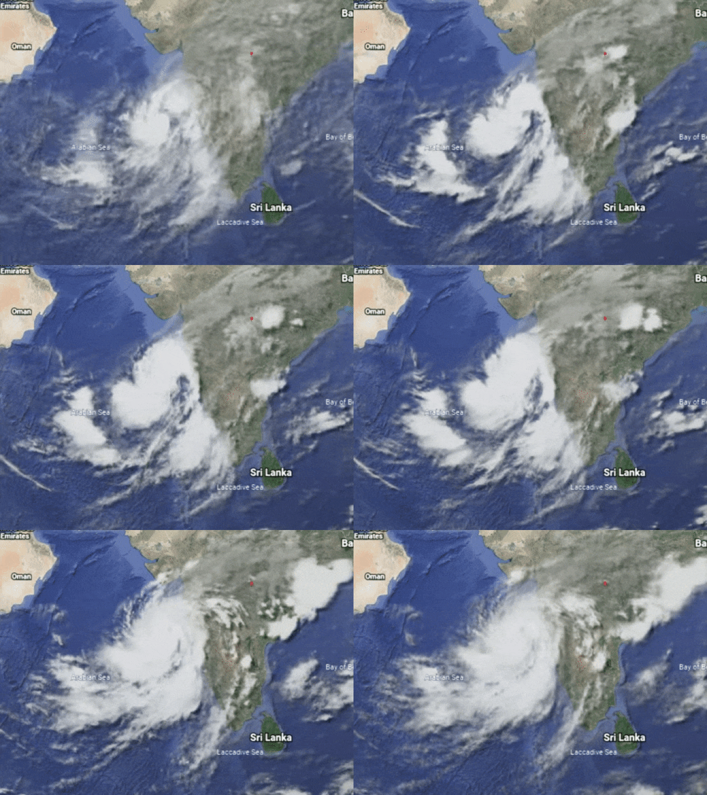
Google Earth shows how clouds have been building up over the past 24 hours before the onset of Cyclone Nisarga
Google Earth
Google Earth doesn’t have live images of clouds, but it can loop the cloud build up over the last 24 hours as seen in the image above. You can track the changes using an app on your phone or open up the application on Google Chrome.
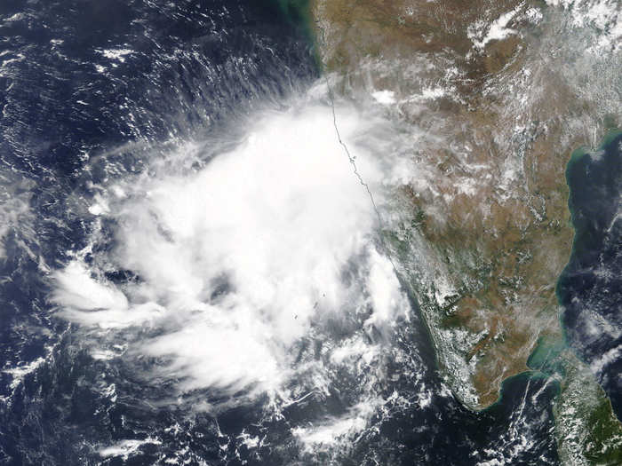
Here’s what Cyclone Nisarga looked like on May 31
NASA/EOSDIS
By June 2, you can see Cyclone Nisarga having pushed its way up towards the coast towards Maharashtra
NASA/EOSDIS
This is what Cyclone Nisarga looks like right now, after 12:00pm on June 3
IMD
The India Meteorological Department (IMD) has upgraded the Nisarga from a cyclone to a severe cyclonic storm. The difference in the classification are the wind speeds. A cyclone exhibits wind speeds between 63 to 88 kilometres per hour (kmph), whereas a severe cyclonic storm has speeds of between 89 to 117 kmph.

