Here's when the 'bomb cyclone' will hit, how cold it will be, and how much snow will fall on the East Coast
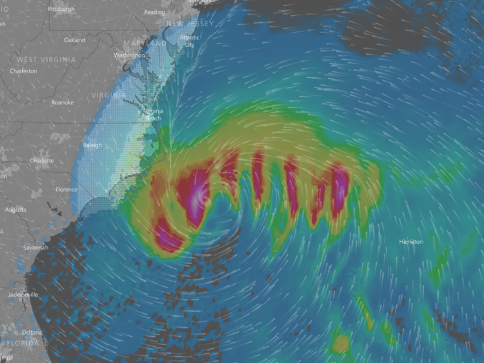
As of 4:00 p.m. on Wednesday afternoon, the storm was hanging out off the coasts of Florida and Georgia.

By midnight on Thursday, the storm will creep toward North Carolina's coast and start impacting Baltimore and Washington DC
Washington DC and Baltimore, shown toward the top of the map, will be hit with minor snowfall on Wednesday night through Thursday morning. Temperatures in those cities will plummet to the single digits as the storm draws frigid polar air from the Canadian Arctic, according to the National Weather Service.
Temperatures in DC will fall to a low of 9 degrees Fahrenheit on Thursday evening, hitting a maximum low of 6 degrees on Saturday night. Daytime temperatures are expected to climb back into the teens as long as the storm doesn't deviate too far from its expected track.
By 8 a.m. Thursday, the storm's center will be sitting just off the coasts of Virginia, Maryland, and southern New Jersey.
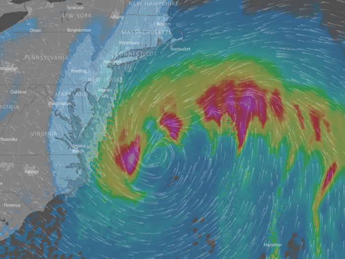
The storm will drop between 5 and 8 inches of snow in New York City and Philadelphia from Wednesday night through Thursday evening. New Jersey's coast, however, will see significantly more snow: Up to a foot is expected in parts of New Jersey and Long Island.
If the storm veers further east, snowfall accumulation could increase in New York City and Philadelphia. In any case, neither New York nor Philadelphia will be spared from frigid conditions.
Temperatures in both cities will drop to the low single digits on Friday evening, with the coldest temperatures on Saturday night. With the windchill factored in, it'll feel as cold as -35 on Saturday. Both New York and Philadelphia are under a winter storm warming from Thursday at 1 a.m. through Friday at 1 a.m., according to the National Weather Service.
By 4 p.m. on Thursday, the storm will be just off the coast of Cape Cod, Massachusetts, dumping up to 2 inches of snow per hour on most of Massachusetts and parts of Rhode Island, Connecticut, and Maine.
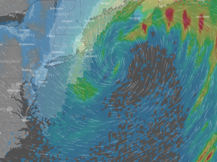
Boston is under a blizzard warning starting at 7 a.m. Thursday and continuing through 7 p.m. that evening. The city is expected to receive up to a foot of snow, which will start falling Wednesday night and get heavy on Thursday morning.
Parts of eastern Massachusetts and Cape Cod will be at risk of flooding from heavy snowfall and a tidal surge associated with the storm, according to the National Weather Service.
After the storm moves north, Boston will be hit with frigid temperatures. By Saturday night, temperatures are expected to sink to -6 Fahrenheit, before the wind chill, with wind gusts up to 60 miles per hour.
At midnight on Friday, the storm will have moved up to the Canadian Maritimes, sitting over Nova Scotia and New Brunswick.
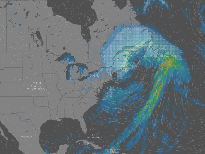
As you can see on the map, the circulation associated with the low-pressure center of the storm will drag frigid Arctic air over the Northeast. Temperatures across the region are expected to plunge into the single digits over the weekend — and below zero in some cases — with wind chills well below zero in New York and Boston.
By Sunday, temperatures are expected to creep back up to a more normal range across the region.
Advertisement