BEFORE AND AFTER: Aerial Pictures Show Super Typhoon Haiyan's Catastrophic Damage
Typhoon Haiyan hit the coast of the Philippines in the Early morning of November 7. It was so huge it was visible from space in this image of the globe.

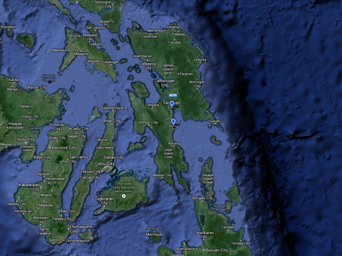
Tacloban City and Dulag are located on the edge of the islands facing the ocean. Tacloban city has more coverage because it's set on a bit of an inlet, but that might have caused a larger storm surge in the area if the water had no where else to go.
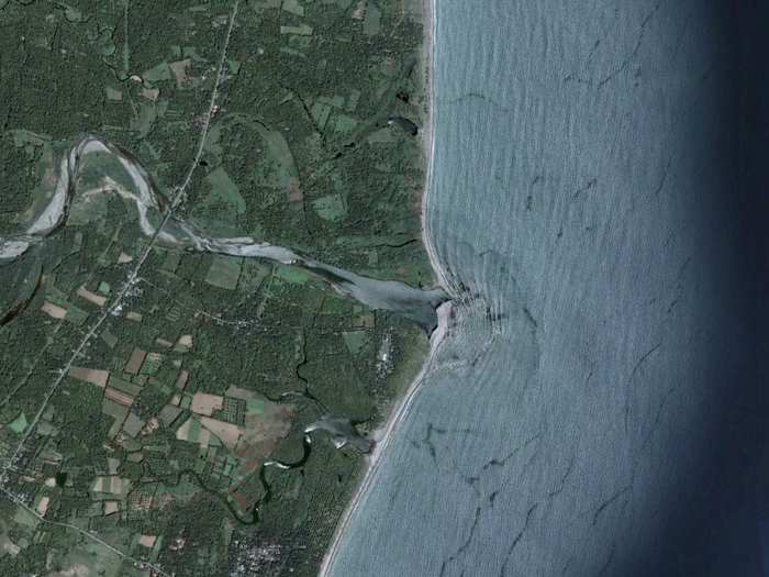
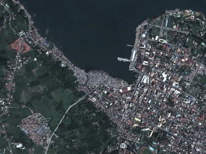
This is the Philippine city of Dulag on Sept. 11 of 2006.
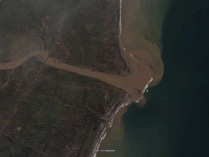
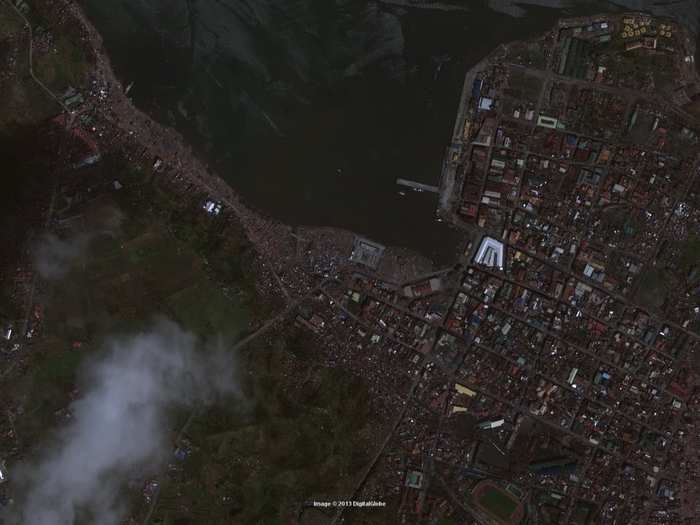
Here's Dulag on Nov. 13, after the storm. The storm mixes up the dirt and water, which is pulled out to sea as the surge retreats.
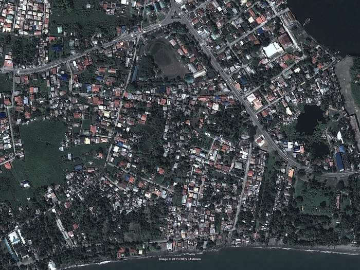
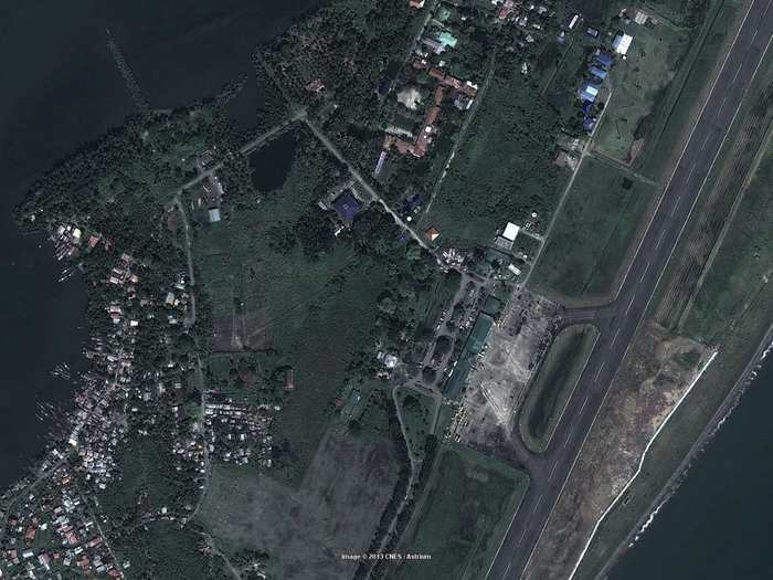
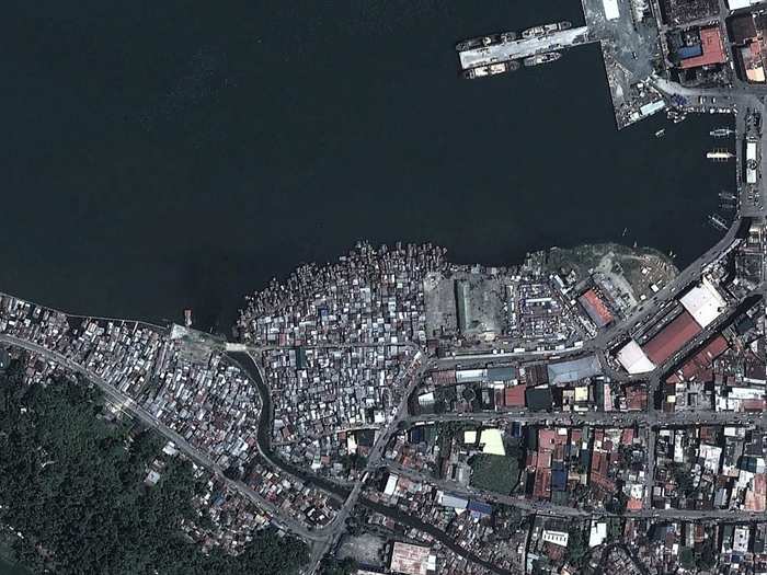
Here's Tacloban City on Feb. 22, 2012.
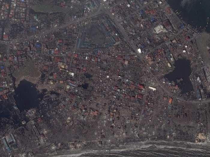
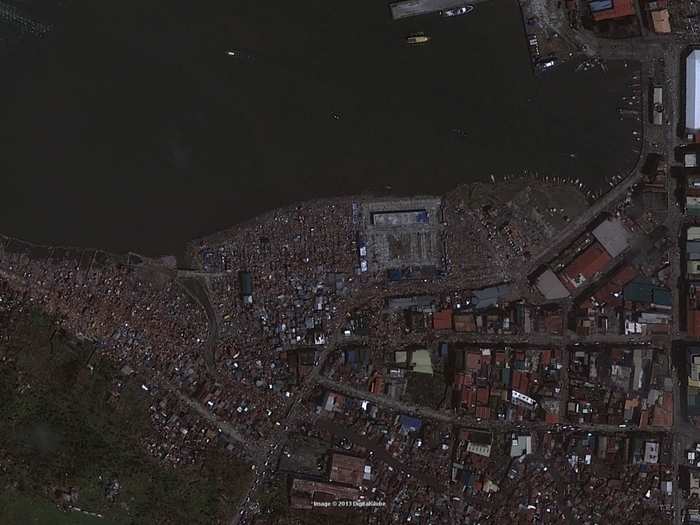
Here's Tacloban City on Nov. 12. The damage is worse than a tornado.
Here's Tacloban City on Feb. 22, 2012.
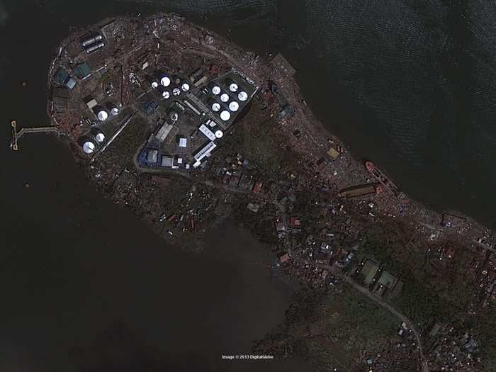
Here's Tacloban City on Nov. 12.

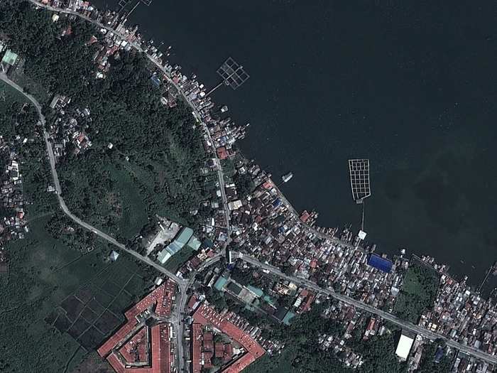
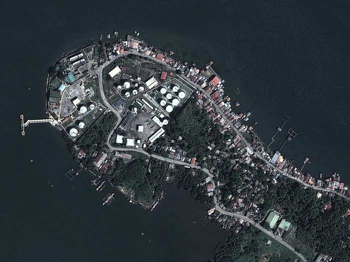
Here's Tacloban City on Feb. 22, 2012.
Here's Tacloban City on Nov 10.
Here's Tacloban City on Feb. 221, 2012.
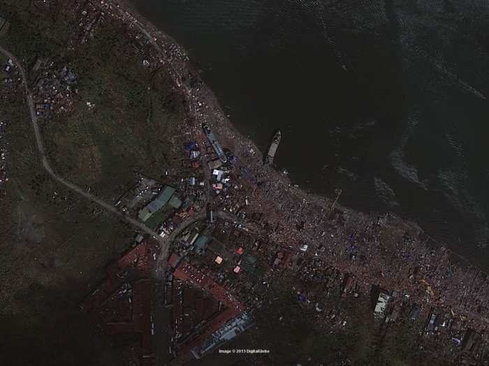
Here's Tacloban City on Nov 10. The whole coastal area is just washed away.
Here's Tacloban City on Feb. 22, 2012.
Here's Tacloban City on Nov 10.
Here's Tacloban City on Feb. 221, 2012.

Here's Tacloban City on Nov 10.
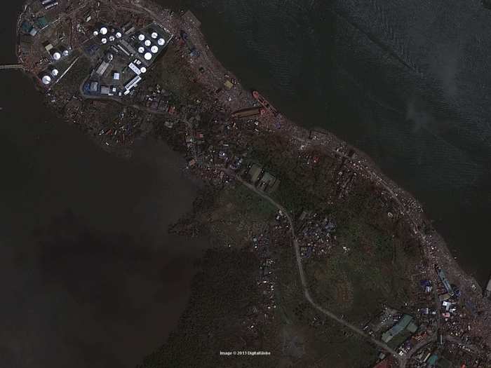
Here's Tacloban City on Feb. 221, 2012.
Here's Tacloban City on Nov 10.
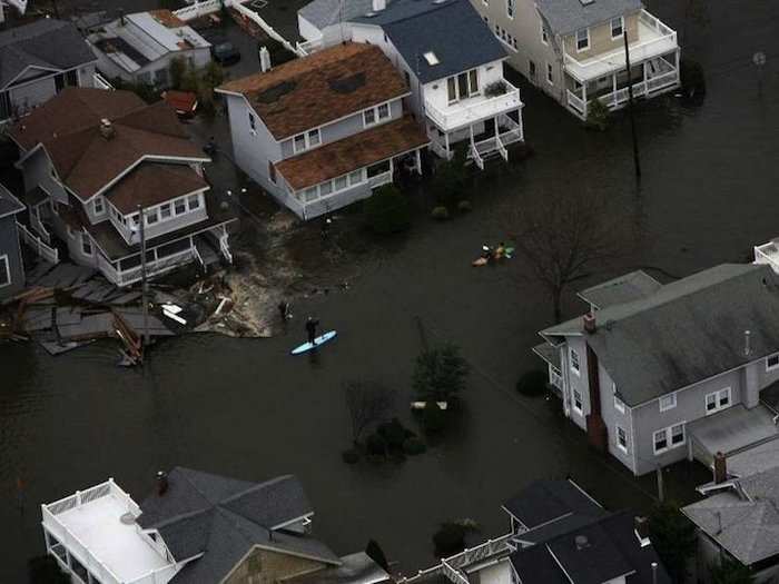
Now see the devastation from the worst storm to his the U.S. since Hurricane Katrina.

Popular Right Now
Popular Keywords
Advertisement