These declassified maps show how the CIA saw the world at the height of the Cold War
Chinese railroad construction in the mid-1950s.

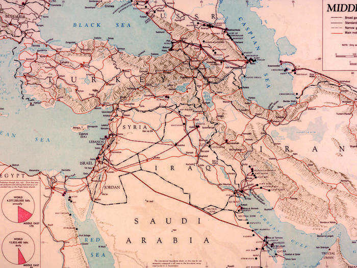
Oil transport and refining facilities in the Middle East in the early 1950s.
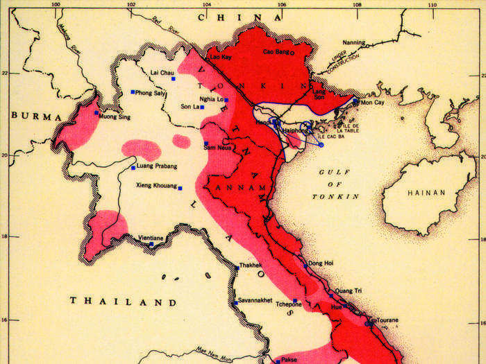
A map of French and Viet Minh areas of operations during the 1950s.
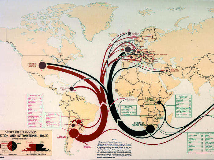
International trade flows in the 1950s.
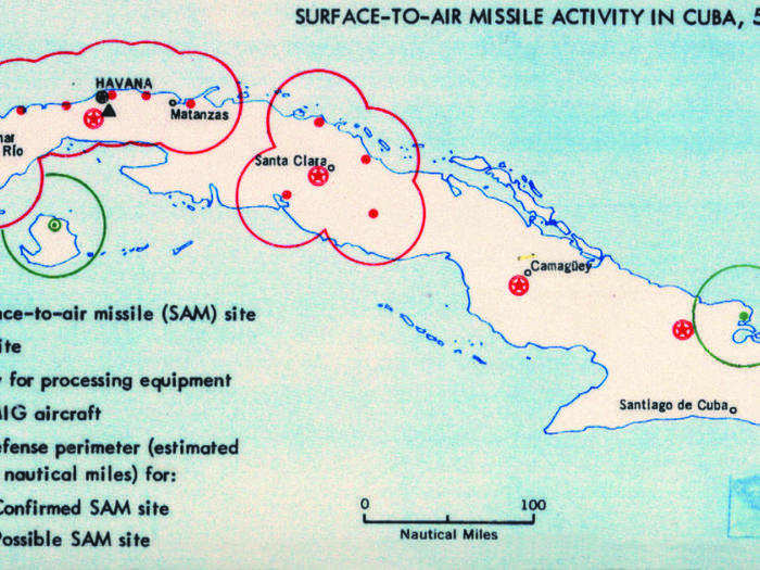
Suspected sites of missiles in Cuba, 1962.
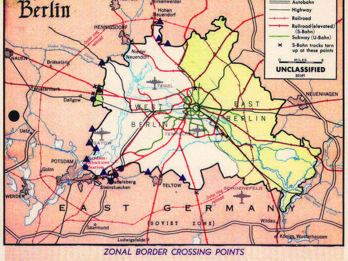
Transportation routes in and around West and East Berlin in the 1960s.
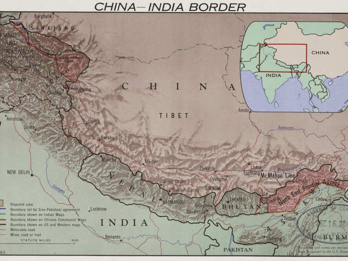
The China-India border region in 1963.
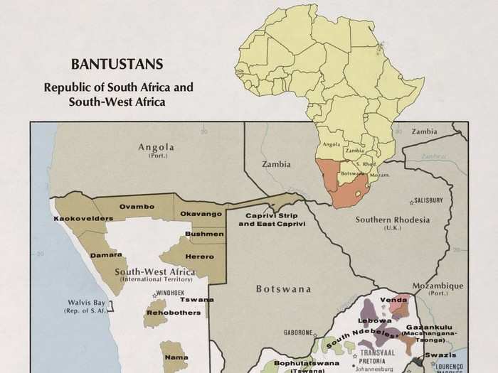
Bantustans in South Africa in 1973.
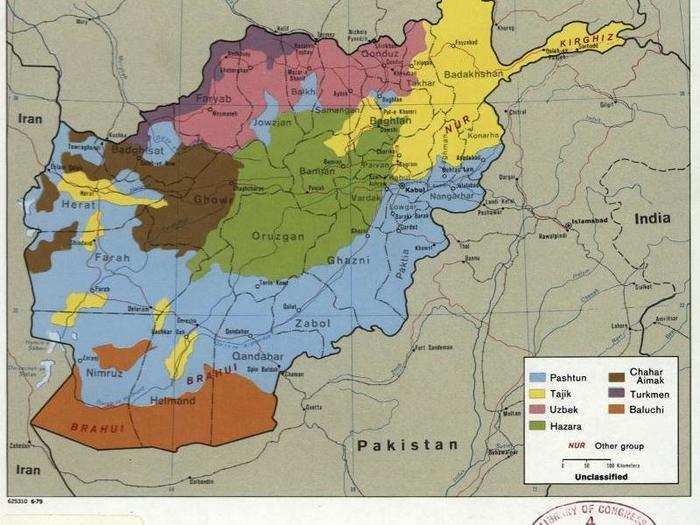
Ethnic groups in Afghanistan in 1979.
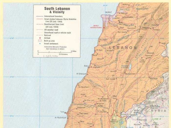
Southern Lebanon and environs in 1977.
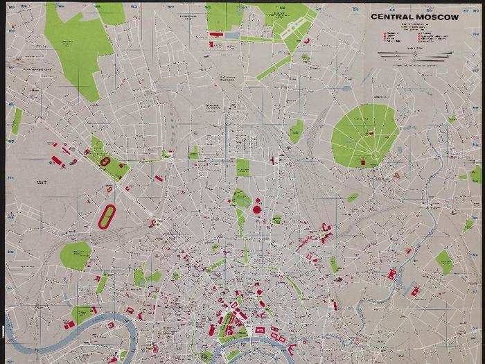
Central Moscow in 1980.
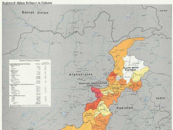
Population changes due to refugee movement on the Afghanistan-Pakistan border, 1982.
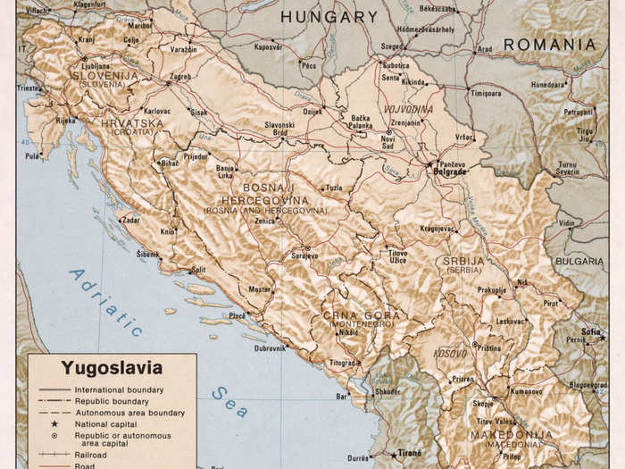
Yugoslavia in 1981.
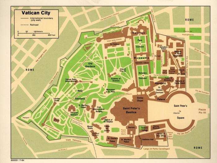
Vatican City, 1984.

Popular Right Now
Popular Keywords
Advertisement