Beautiful pictures taken by astronauts and satellites show the international borders that are visible from space
Widespread poverty in North Korea plunges the country into darkness at night.

The floodlit India-Pakistan border is visible as an orange glow.
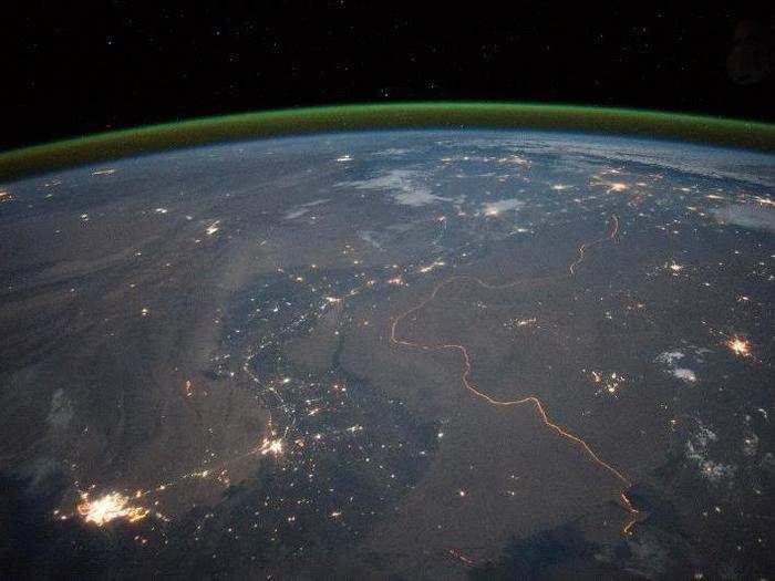
2,000 kilometres of the India-Pakistan border is floodlit and thousands of troops are permanently posted along it.
Known as the Radcliffe Line, the border is one of the most heavily militarised in the world and has a fence running its entire distance as a way of discouraging smuggling and arms trafficking.
This photo was taken using a Nikon D4 digital camera and a 28-millimetre lens.
The border between China and Kazakhstan is a colourful illustration of the countries' agriculture practices.
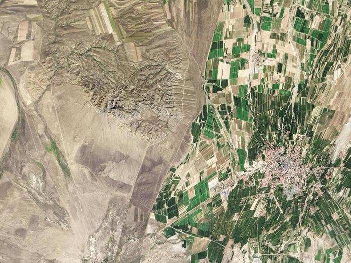
The green land in China is a striking contrast to Kazakhstan's arid landscape in the west.
Just over 11% of China's land is arable, meaning farmers will use just about any space they can to grow crops to feed the country's 1.3 billion people.
Only 0.03% of Kazakhstan’s land is devoted to permanent agriculture, and it plays a small part in the country's economy. The country has a few industrial-sized farms dotted throughout, but the land along the border with China is sparsely used.
Egypt's border with Israel is marked by the formation of sand dunes and farming practices.
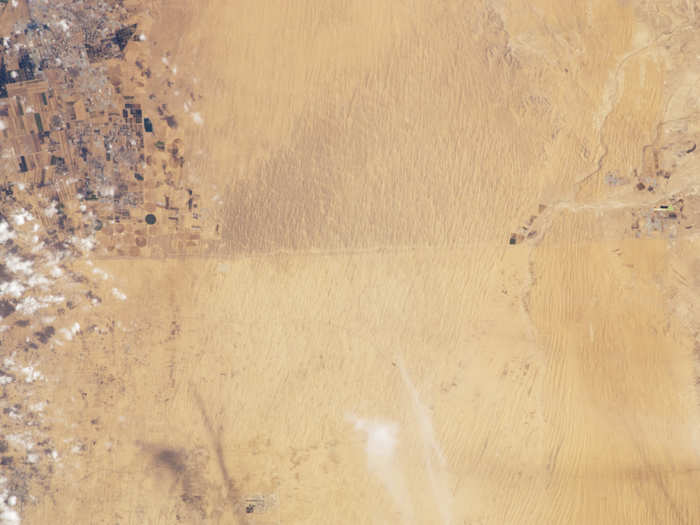
The Egypt-Israel boundary is highlighted by the soil choices of the countries' agriculture industries. It's visible, but only just.
The different colours of the land are the result of the trampling of humans and their livestock.
On the north side, Israel has fields rich with crops, but neighbouring Egypt's landscape is much emptier.
A dirt track also helps to define the border.
The Abuna river forms part of the border between Brazil and Bolivia.
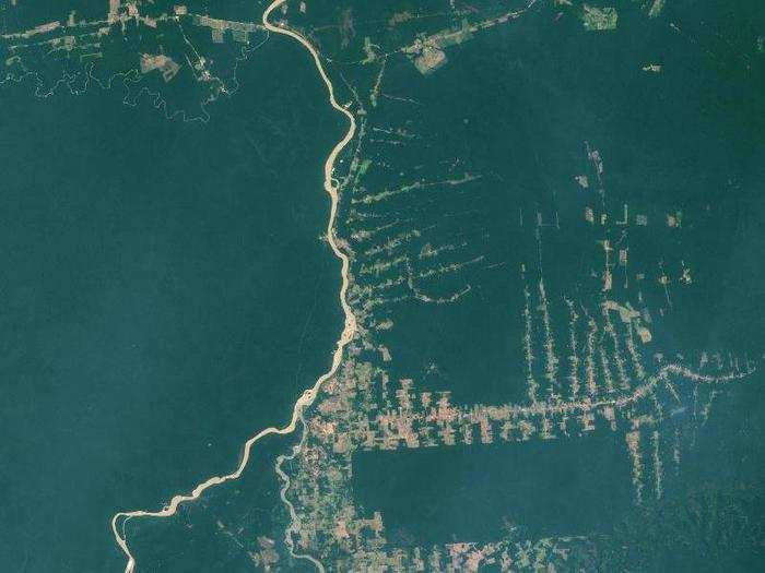
The Abuna river runs from near the top of the image outlining the northern border of Bolivia with Brazil.
It meets the Madeira river to form the northernmost border of Bolivia, while the Manora river comes up from the south at the same river confluence, marking the eastern border of Bolivia.
The Iraq-Iran border is marked by military fortifications, gun emplacements, and connecting roads.
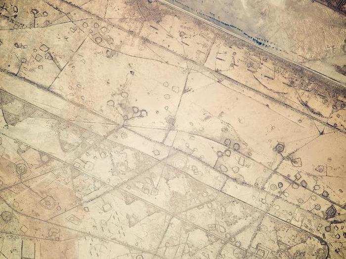
This 12-mile stretch of border between Iraq and Iran near the Persian Gulf is outlined by the instalment of circular gun emplacements, connecting roads, and land fortifications that run parallel to the boundary.
Astronauts on the ISS first thought they were seeing oil-pad installations, but the strategic location of these formations made it clear that these were patterns of military fortifications.
The US-Mexico border looks totally different when viewed through an infrared lens.
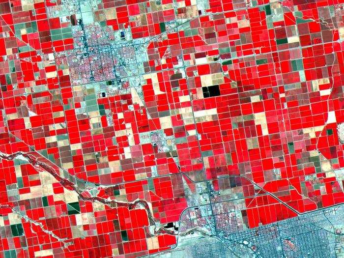
This photo was taken by the Advanced Spaceborne Thermal Emission and Reflection Radiometer.
It highlights the difference in landscape between the US and Mexico. On the north side is the US, which is covered in rich farmland (coloured in red), while the barren expanse of land in Mexico is punctuated with fields.

Popular Right Now
Popular Keywords
Advertisement