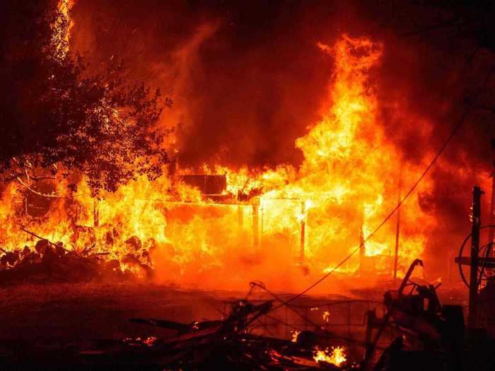
A law enforcement officer watches flames launch into the air as fire continues to spread at the Bear fire in Oroville, California on September 9, 2020.Josh Edelson/AFP via Getty Images
- California's wildfires have already eaten up a record 2.3 million acres across the state, resulting in at least eight deaths and 3,700 destroyed structures.
- Three major fire complexes are nearly contained after weeks of effort from firefighters, but a number of other blazes continue to rip through the state unabated.
- Striking before and after photos show the areas of California that have been ravaged by the fires — and what they looked like before the flames struck.
Wildfires propelled by fierce winds and dry air have roared across California and Oregon in recent weeks, prompting hundreds of rescues and forcing tens of thousands of evacuations.
The damage caused by the fires has been extensive — Gov. Gavin Newsom said at a press briefing on Tuesday that 7,606 fires have burned 2.3 million acres so far this year, setting a record. By the same time last year, 4,927 fires had burned just 118,000 acres, according to The New York Times.
As of Wednesday, California's fires have resulted in eight deaths and more than 3,700 structures destroyed, according to the California Department of Forestry & Fire Protection. The agency said more than 14,000 firefighters were battling 28 major wildfires across the state.
Three major fire complexes — known as LNU, SCU, and CZU — spanned multiple North Bay and East Bay counties, as well as the San Mateo and Santa Cruz counties just south of San Francisco. Those fire complexes consumed a cumulative 850,000 acres, though they're nearly contained.
These before-and-after photos show the extent of the damage.
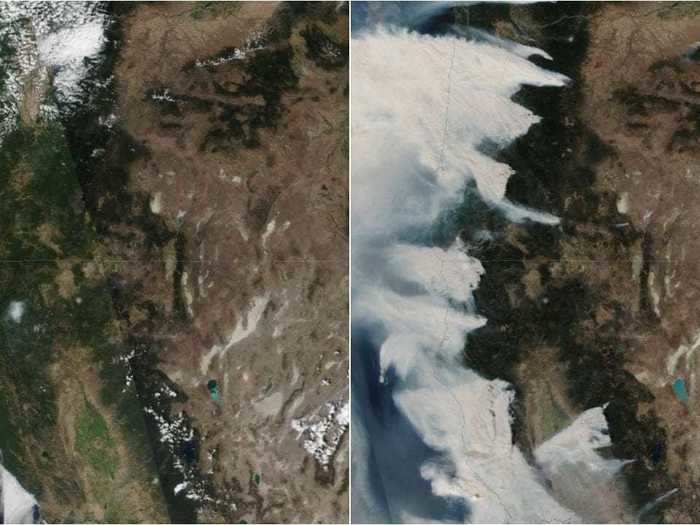
Satellite images from NOAA show massive swaths of smoke emitting from wildfires dotted across California and Oregon. This composite image shows how the states looked on August 8 compared to September 8.
These satellite images show Oregon and Northern California on August 8, left, and September 8, right.
NASA Worldview
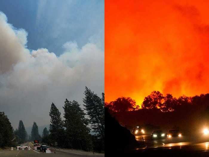
The Creek Fire in Sierra National Forest in Fresno County has already burned up more than 163,000 acres and remains 0% contained. These images show the Creek Fire blaze along different parts of the CA-168 on September 7 and September 8.
The Creek Fire jumped CA-168 on Tuesday, Sept. 8, 2020 in Fresno County, CA.
Kent Nishimura / Los Angeles Times via Getty Images
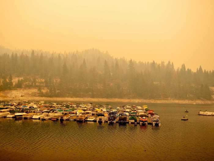
Shaver Lake was hit particularly hard by the Creek Fire. Hundreds of people in the area were trapped for days awaiting rescue by helicopters that struggled to land through the plumes of smoke.
Shaver Lake, an area where hundreds of people became trapped, is seen surrounded by smoke during the Creek fire at Shaver Lake, California on September 07, 2020.
Josh Edelson/AFP via Getty Imags
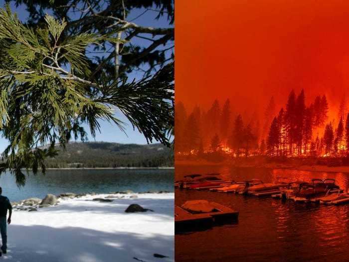
Before and after photos show the lake's normally peaceful banks consumed by flames.
On the left, Shaver Lake's South Shore is covered by winter's snow in 2006. On the right, flames can be seen approaching the Shaver Lake Marina on September 6, 2006.
Don Kelsen/Los Angeles Times via Getty Images; Josh Edelson/AFP via Getty Images
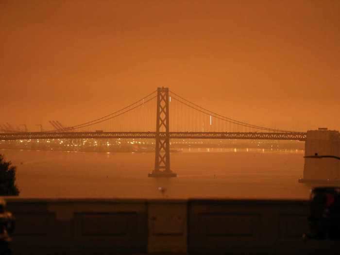
The effects from the wildfires were visible in the skies over the San Francisco Bay Area, which turned an apocalyptic orange on Wednesday.
San Francisco, California, on September 9, 2020.
Katie Canales/Business Insider
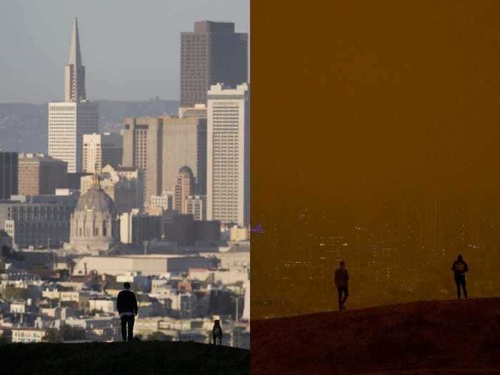
The Bay Area Air District said the fiery skies were caused by ash transported from the Northern California fires. The agency said the particles scatter blue light and only show yellow, orange, and red light, and that the skies could darken if the smoke grows worse.
Photos taken from the from Kite Hill Open Space in San Francisco in 2014, left, and 2020, right, show how the wildfire smoke has obscured the skyline.
Associated Press/Jeff Chiu
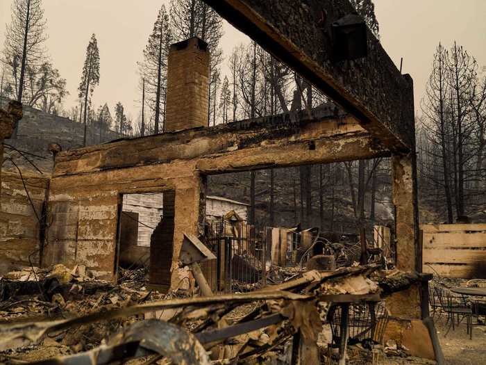
The damage is tangible — buildings and structures across California have undergone fire damage or burnt to the ground entirely.
The smoldering remains of Cressmans General Store and Gas Station along CA-168, where Creek Fire tore through and jumped CA-168 on Tuesday, Sept. 8, 2020 in Fresno County, CA.
Kent Nishimura/Los Angeles Times via Getty Images
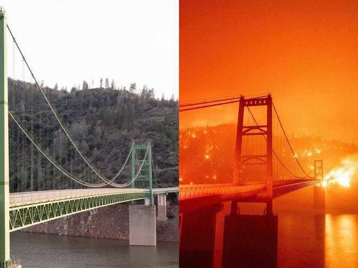
The image to the right shows Lake Oroville's Bidwell Bar Bridge as the Bear Fire eating up Butte County continued to grow on September 9.
On the right, a boat motors by as the Bidwell Bar Bridge is surrounded by fire in Lake Oroville during the Bear fire in Oroville, California on September 9, 2020.
Carol M. Highsmith/Buyenlarge/Getty Images; Josh Edelson/AFP via Getty Images
On September 9, the Bear Fire forced thousands of residents to evacuate from the Lake Oroville area in Butte County roughly 80 miles north of Sacramento.
A home burns during the Bear fire, part of the North Lightning Complex fires in the Berry Creek area of unincorporated Butte County, California on September 9, 2020.
Josh Edelson/AFP via Getty Images
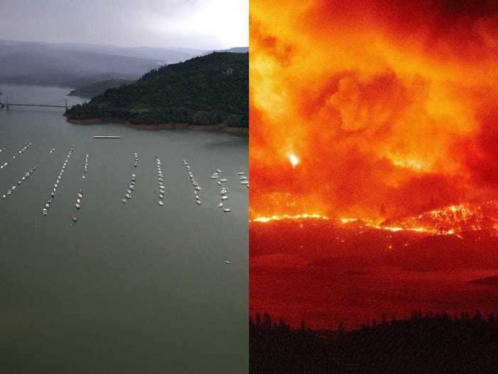
Just three years ago, Lake Oroville struggled to recover from a drought. Now, in 2020, flames from the Bear Fire could be seen licking its shores.
A view of Bidwell Marina at Lake Oroville in 2017, left, and flames surrounding a segment of Lake Oroville, right.
Justin Sullivan/Getty Images; Josh Edelson/AFP via Getty Images

