Images from space show how California's wildfires have torn across the state

- More than 20 major fires are burning in California — an "unprecedented number," according to officials.
- The three biggest blazes have engulfed nearly 500,000 acres.
- Images taken from space show the fires' rapid spread as well as the dry conditions making them stronger.
After nearly 11,000 bolts of lightning struck California in three days earlier this week, firefighters are battling 20 major fires and hundreds of smaller ones — an "unprecedented number," Christine McMorrow, a spokesperson for the California Department of Forestry and Fire Protection, told LAist.
The fires have collectively burned 771,000 acres — an area roughly the size of Rhode Island. Five people have died, and the blazes have forced tens of thousands to evacuate.
Of the more than 560 total fires statewide, the largest and fastest-moving are in Northern California. Two of them, the SCU Lightning Complex and the LNU Lightning Complex, have already become the seventh and 10th largest fires in state history respectively. Each have burned an area larger than New York City.
The fires are so large that they're easily seen from space. Satellite images taken Thursday afternoon captured the devastation from above.
A recent analysis from Stanford University scientists found that California's average precipitation during wildfire season has dropped by 30% since the early 1980s.
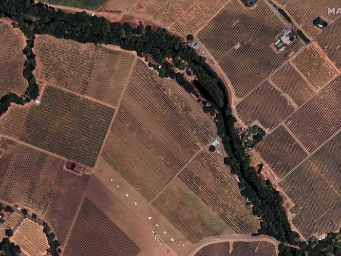
Wildfires gobble up dry foliage, like that seen in the vineyards above. The Stanford analysis also showed that California's average temperatures during wildfire season are 2 degrees Fahrenheit higher than they were in the '80s. Those conditions, which are linked to climate change, have more than doubled the state's total number of extreme wildfire risk days in autumn.
The image below shows the LNU Lightning Complex Fire, which stretches across 219,000 acres in Napa, Solano, Sonoma, and Lake counties, north of San Francisco.
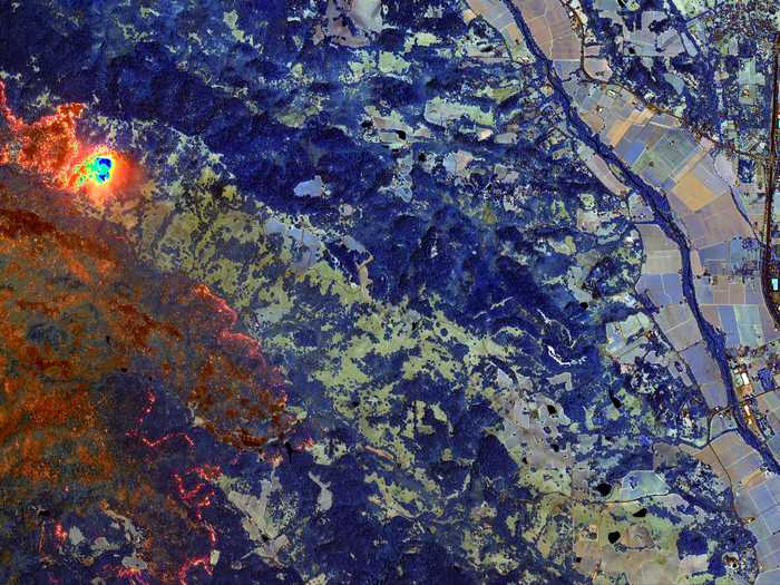
Using infrared technology, satellite technicians can penetrate the dense smoke to show active fire lines and hot spots. In this image, burned vegetation appears orange or rust-colored, while live vegetation appears in shades of blue. Active fires glow orange and yellow.
The LNU Lightning Complex Fire had destroyed at least 480 structures and killed four people.
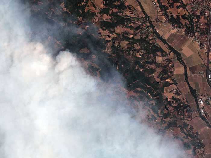
This image shows the LNU Lightning Complex Fire, one of the state's three biggest, as it encroaches on Healdsburg, a small city in Sonoma County.
Smoke from the fires has blanketed most of the state, lowering air quality.
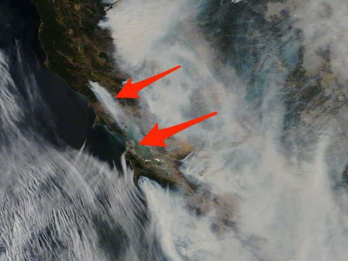
Across California, the three big fires, along with 22 other major wildfires and over 300 smaller ones, have contributed to a statewide curtain of smoke. In the image above, red arrows point to Santa Rose (north) and San Francisco (south), two areas with unhealthy air due to the smoke.
Most of the state's north and central regions are reporting unhealthy air quality, with some reporting hazardous outdoor air. The Bay Area Air Quality Management District has issued "Spare the Air" alerts through Sunday, which prohibit residents from burning wood.
During previous bouts of poor air due to wildfires, fire-safety experts have recommended people stay inside as much as possible and wear N95 masks when outdoors, since those filter out smoke particles. But given lingering shortages of N95s, many Californians lack effective masks.
READ MORE ARTICLES ON
Popular Right Now
Advertisement